
Flight Plan Series
Download and fly as many flight plans as you like! Just download and unzip the flight plan files and open them in Microsoft Flight Simulator – World Map, or use Simflightplan™ to change your aircraft, modify waypoints or create your own flight plans and share them here. Happy Flying!
Check out the Frequently Asked Questions page or our YouTube Channel.
You can search for specific flight plans by city/place names or ICAO code or even by author name to find your own or your friends flight plans.
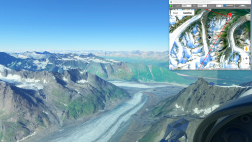
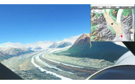
This is the 29th leg of the Pacific Northwest series and takes off form Merle K (Mudhole) Smith Airport and winds through the valleys and glaciers of southern Alaska, winding north to Valdez.
This is the flight plan used in the YouTube video: https://youtu.be/K1F_XWD2_Es
PACV-PAVD Cordova to Valdez
DA40-NG Asobo
PACV: MERLE K SMITH (MUDHOLE) AIRPORT
USR01: [12.17 NM] HAWKINS ISLAND
USR02: [13.39 NM] CONFLUENCE
USR03: [18.49 NM] GLACIERS
USR04: [19.23 NM] LOWE RIVER
USR05: [7.95 NM] APPROACH
PAVD: [7.28 NM] VALDEZ AIRPORT
Total Distance: 78.53 NM
Flightplan by texstan
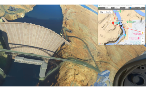
This is the third leg of the Navajo Volcanic Field series. This flight plan starts Oljato Regional Airport in Monument Valley, so take a quick spin around the famous buttes before flying west over the San Juan River to the Glen Canyon Dam. This is the bottom steps of the Grand Staircase Escalante formation. You can fly down Marble Canyon to the Grand Canyon, or on a clear day gain some altitude over Page and you’ll see it to the southwest.
This is the flight plan used in the YouTube video https://youtu.be/hckXQfIU0p4
UT25 to KPGA Monument Valley to Page Municipal
DA40-NG Asobo
UT25: OLJATO REGIONAL AIRPORT
USR01: [17.99 NM] MONITOR BUTTE
USR02: [4.98 NM] ZAHN BAY
USR03: [5.65 NM] PIUTE BAY
USR04: [9.92 NM] REFLECTION CANYON
USR05: [6.30 NM] RAINBOW BRIDGE
USR06: [9.55 NM] TOILET BOWL
USR07: [5.88 NM] HEPBURN’S BATHTUB
USR08: [11.24 NM] WAHEEP BAY
USR09: [4.40 NM] GLEN CANYON DAM
KPGA: [2.17 NM] PAGE MUNICIPAL AIRPORT
Total Distance: 78.13 NM
Flightplan by texstan
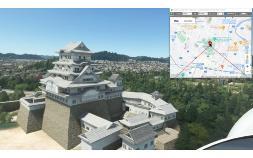
This flight plan starts in Osaka, Japan and winds south to Takamatsu. Along the way there are a number of temples and shrines along with the spectacular Himeji Castle and the Akashi-Kaikyo Bridge.
This is the flight plan used in the YouTube video https://youtu.be/_UhnjfpJ6G0
RJOY-RJOT Yao to Takamatsu
Asobo NXCub
RJOY: YAO AIRPORT
USR01: [7.30 NM] HORYUJI TEMPLE
USR02: [27.40 NM] KOBE TOWER
USR03: [9.04 NM] AKASHI-KAIKYO BRIDGE
USR04: [20.95 NM] HIMEJI CASTLE
USR05: [43.19 NM] TAKAMATSU CASLTE PARK
RJOT: [8.30 NM] TAKAMATSU AIRPORT
Total Distance: 116.20 NM
Flightplan by texstan
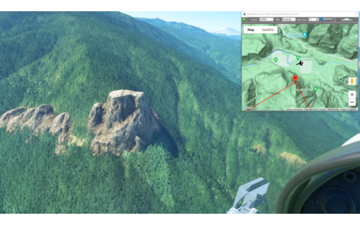
This is an update to the second leg of the Pacific Northwest series. Since the original flight plan, MSFS has added Points of Interest for Ryan Lake, Tower Rock, Tahk Takh Lava Flow and Riffe Lake Dam (AKA Mossy Rock Dam), so these points have been added to the original flight to the crater of Mt St Helens.
This is the flight plan used in the YouTube video https://youtu.be/76bNJJt-XsI
KPDX to 39P Portland to Morton
DA40-NG Asobo
KPDX: PORTLAND INT’L
USR01: [25.76 NM] YALE DAM
USR02: [15.22 NM] MT ST HELENS
USR06: [10.63 NM] RYAN LAKE
USR04: [12.60 NM] JUMBO PEAK
USR03: [7.91 NM] TAHK TAHK LAVA FLOW
USR05: [14.86 NM] TOWER ROCK
USR07: [23.76 NM] MOSSY ROCK / RIFFE LAKE DAM
39P: [6.58 NM] STROM FIELD
Total Distance: 117.36 NM
Flightplan by texstan

This flight plan takes off from the crest of a glacier ridge and heads east over the Million Dollar Bridge at Miles Lake and lands and Merle K (Mudhole) Smith Airport.
This is the flight plan used in the YouTube video https://youtu.be/4-mqDL0HD9w
GLA1-PACV Glacier to Cordova
Asobo XCub Skis
GLA1: GLACIER TAKEOFF
WP1: [43.48 NM] MILES LAKE & MILLION DOLLAR BRIDGE
WP2: [16.20 NM] TURN SOUTH
WP3: [17.64 NM] CORDOVA
PACV: [6.51 NM] MERLE K (MUDHOLE) SMITH AIRPORT
Total Distance: 83.83 NM
Flightplan by texstan
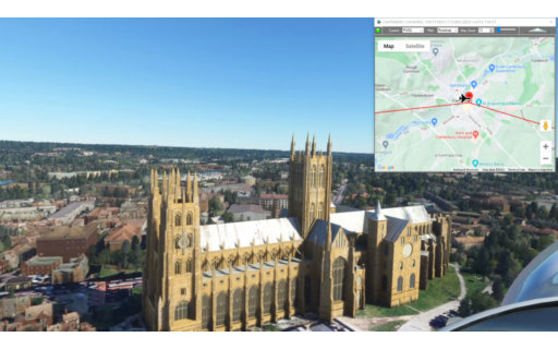
This flight plan is a collection of places from the Mysteries of the Abandoned TV show on Science Channel, located in the south east of England. It’s actually a number of waypoints that were left over from the previous MOTA Preview. MSFS World Map points of interest for the area are also included, such as Dover Cliffs and Canterbury Cathedral in addition to a number of famous landmarks found on Google Maps.
This is the flight plan used in the YouTube video https://youtu.be/w8ox0Y8szfM
EGMD-EGMC Lydd to Southend-on-Sea
Asobo NXCub
EGMD: LYDD AIRPORT
S4E3-4: [0.85 NM] SOUND MIRRORS – AIRCRAFT DETECTION
POI01: [17.86 NM] CLIFFS OF DOVER
WP1: [5.87 NM] DEAL CASTLE
POI02: [12.56 NM] CANTERBURY CATHEDRAL
WP2: [17.11 NM] LEEDS CASTLE
POI03: [4.31 NM] ARCHBISHOPS PALACE – MAIDSTONE
S1E6-2: [7.51 NM] U-475 BLACK WIDOW – SOVIET SUBMARINE
POI04: [11.41 NM] SOUTHEND PIER
EGMC: [2.44 NM] LONDON SOUTHEND AIRPORT
Total Distance: 79.97 NM
Flightplan by texstan
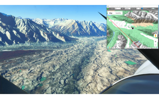
This flight plan takes off McCarthy Airport at the foot of a massive glacier and continues south through scenic valleys until we use our skis to land at the crest of a glacier ridge.
PAMX-GLA1 McCarthy Airport to Glacier Landing
Asobo XCub Skis
PAMX: MCCARTHY AIRPORT
WP1: [17.79 NM] TANA CANYON
WP2: [9.62 NM] GLACIER LAKE
WP3: [19.08 NM] GLACIERS
GLA1: [14.67 NM] GLACIER LANDING
Total Distance: 61.17 NM
Flightplan by texstan
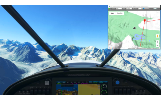
This flight plan takes off from a glacier plateau at Mt Benkin, and flies down the valley until you reach McCarthy at the foot of a massive glacier.
This is the flight plan used in the YouTube video https://youtu.be/GoL1dy3w-Dw
GLA1-PAMX Burwash Landing to Mt Benkin
Asobo XCub Skis
GL1: MT BENKIN GLACIER TAKEOFF
WP1: [17.87 NM] GLACIER CONFLUENCE
WP4: [52.04 NM] CAMEL LAKE
PAMX: [7.87 NM] MCCARTHY AIRPORT
Total Distance: 77.79 NM
Flightplan by texstan
This is the 25th leg of the Pacific Northwest Series. Take off from Burwash Landing Airport, and fly north over the mountains and glaciers to land on a plateau near the top of Mt. Benkin.
This is the flight plan used in the YouTube video https://youtu.be/S8XHre8cCb4
CYDB-PAMX Burwash Landing to Glacier
Asobo XCub Skis
CYDB: BURWASH LANDING AIRPORT
WP1: [32.46 NM] SPRIING GLACIER PEAK
WP2: [11.94 NM] MT WALDEN
WP3: [22.71 NM] US / CANADA BORDER
GL1: [5.13 NM] MT BENKIN GLACIER LANDING
Total Distance: 72.25 NM
Flightplan by texstan

This flight plan starts in Charleston, SC and follows the Atlantic coast north to the Outer Banks, Cape Hatteras and Kitty Hawk/Kill Devil Hills. Along the way there are multiple forts and lighthouses, and if you take a side-trip up the Cape Fear River to Wilmington, the Battleship North Carolina is berthed along the river.
This is the flight plan used in the YouTube video https://youtu.be/WLYM6ZBanP0
KJZI-KFFA Charleston to Kill Devil Hills
Asobo NXCub
KJZI: CHARLESTON EXECUTIVE AIRPORT
USR01: [6.53 NM] MORRIS ISLAND LIGHTHOUSE
USR02: [3.44 NM] FORT SUMTER
USR02_0: [1.64 NM] SULLIVANS ISLAND LIGHTHOUSE
USR03: [28.32 NM] CAPE ROMAINE LIGHTHOUSE
USR05: [47.55 NM] MYRTLE BEACH
USR06: [43.69 NM] OAK ISLAND LIGHTHOUSE
USR07: [82.74 NM] FORT MACON
USR08: [42.01 NM] OCRACOKE ISLAND
USR09: [24.03 NM] CAPE HATTERAS LIGHTHOUSE
USR10: [34.15 NM] BODIE ISLAND LIGHTHOUSE
KFFA: [13.11 NM] FIRST FLIGHT – KILL DEVIL HILLS
Total Distance: 327.26 NM
Flightplan by texstan