
Flight Plan Series
Download and fly as many flight plans as you like! Just download and unzip the flight plan files and open them in Microsoft Flight Simulator – World Map, or use Simflightplan™ to change your aircraft, modify waypoints or create your own flight plans and share them here. Happy Flying!
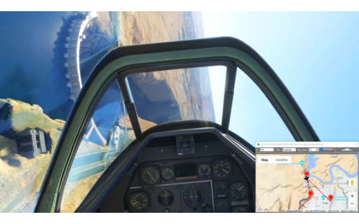
Check out the Frequently Asked Questions page or our YouTube Channel.
You can search for specific flight plans by city/place names or ICAO code or even by author name to find your own or your friends flight plans.

This is the final leg of the 31 leg Pacific Northwest Series that started in the Columbia River Gorge in Oregon and lands at Anchorage Int’l at the end of this leg. Take off from Glacier View and fly over several glaciers including Knik Glacier before flying over scenic Chugach State Park before an easy landing on the big runways of Anchorage Int’l.
PASP-PANC Sheep Mt Airstrip to Anchorage
DA40-NG Asobo
PASP: SHEEP MOUNTAIN AIRSTRIP
USR01: [18.66 NM] ICING PEAK
USR02: [14.78 NM] MT GOODE
USR03: [13.91 NM] KNIK GLACIER
USR04: [17.74 NM] CHUGACH STATE PARK
USR05: [17.40 NM] LONG LAKE
PANC: [13.20 NM] ANCHORAGE INTL AIRPORT
Total Distance: 95.70 NM
Flightplan by texstan

BEST LAP: 1 – 00:10:58
Snake River Canyon Blast
Boeing F/A 18E Super Hornet Asobo
READY: GET READY
START: [7.85 NM] START TIMING
WP2: [4.73 NM] HELLER BAR
WP3: [8.99 NM] COUGER RAPIDS
WP4: [9.55 NM] CHINA GULCH
WP5: [5.34 NM] BOULDER RAPDIS
WP6: [5.41 NM] HIGHRANGE RAPIDS
WP7: [7.52 NM] PITTSBURG LANDING
WP8: [9.66 NM] SHEEP CREEK
WP9: [12.46 NM] BRUSH CREEK
WP10: [7.74 NM] HELLS CANYON
WP11: [9.73 NM] HOLBROOK CREEK
WP12: [2.66 NM] OXBOW DAM
WP13: [2.54 NM] LIMESTONE GULCH
FINISH: [5.13 NM] STOP TIMING
END: [4.76 NM] END
Total Distance: 104.14 NM
Flightplan by texstan
OFFICIAL TIMES
BEST [1] – 00:10:58
| WAYPOINT | LAP 1 |
| START | 5/31/2023 8:26:37 PM |
| WP2 | 00:00:31 |
| WP3 | 00:01:34 |
| WP4 | 00:01:38 |
| WP5 | 00:00:42 |
| WP6 | 00:00:38 |
| WP7 | 00:00:47 |
| WP8 | 00:01:03 |
| WP9 | 00:01:18 |
| WP10 | 00:00:46 |
| WP11 | 00:00:59 |
| WP12 | 00:00:16 |
| WP13 | 00:00:15 |
| FINISH | 00:00:31 |
| LAP TIME | 00:10:58 |
BEST LAP: 1 – 00:11:24
First lap time, lost my way and doubled back at Ferguson Ridge.
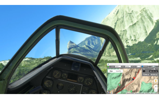
Yosemite Canyon Blast
P51-D Mustang Asobo Reno
READY: GET READY
START: [2.50 NM] START TIMING
TURN 1: [2.86 NM] TIOGA PASS
TURN 2: [2.15 NM] WARREN FORK
TURN 3: [1.00 NM] ELLERY LAKE
TURN 4: [2.17 NM] GRANITE LAKES
TURN 5: [4.13 NM] LEMBERT DOME
TURN 6: [2.67 NM] FAIRVIEW DOME
TURN 7: [3.14 NM] TENAYA LAKE
TURN 8: [3.16 NM] PYWIACK CASCADE
TURN 9: [4.82 NM] HAPPY ISLES LOOP BRIDGE
TURN 10: [3.15 NM] DEVILS ELBOW
TURN 11: [3.95 NM] CASCADES
TURN 12: [2.98 NM] AVALANCHE CREEK
TURN 13: [3.29 NM] EL PORTAL
TURN 14: [4.03 NM] FERGUSON RIDGE
TURN 15: [4.69 NM] BRICEBURG
TURN 16: [1.78 NM] MCCABE FLAT
TURN 17: [2.00 NM] RAILROAD FLAT
FINISH: [2.61 NM] FINISH TIMING
END: [1.75 NM] END
Total Distance: 58.92 NM
Flightplan by texstan
OFFICIAL TIMES
BEST [1] – 00:11:24
| WAYPOINT | LAP 1 |
| START | 5/28/2023 10:57:13 PM |
| TURN 1 | 00:00:30 |
| TURN 3 | 00:01:07 |
| TURN 4 | 00:00:27 |
| TURN 5 | 00:00:42 |
| TURN 6 | 00:00:25 |
| TURN 7 | 00:00:33 |
| TURN 8 | 00:00:31 |
| TURN 9 | 00:00:47 |
| TURN 10 | 00:00:34 |
| TURN 11 | 00:00:42 |
| TURN 12 | 00:00:40 |
| TURN 13 | 00:00:36 |
| TURN 14 | 00:00:51 |
| TURN 15 | 00:02:01 |
| TURN 16 | 00:00:24 |
| TURN 17 | 00:00:30 |
| FINISH | 00:00:34 |
| LAP TIME | 00:11:24 |
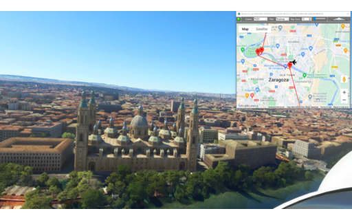
This flight plan is a collection of places from the Mysteries of the Abandoned TV show on Science Channel, located in the Northern Spain. MSFS World Map points of interest for the area are also included as waypoints, including the Basilica de Nuestra Senora del Pilar and the Third Millenium Bridge in Zaragoza
LERS-LFBT Reus to Tarbes-Lourdes Airport
Asobo NXCub
LERS: REUS AIRPORT
POI07: [3.85 NM] AQUEDUCT DE LAS FERRERES
WP1: [1.93 NM] ROMAN AMPHITHEATER
WP2: [5.02 NM] CASTELL DE VILA SECA
WP3: [12.37 NM] CASTELL DE LA MOLA
S6E9-3: [18.12 NM] CORBRERA D’EBRE
S3E6-1: [56.93 NM] BELCHITE RUINS – SPANISH CIVIL WAR
POI01: [21.99 NM] BASILICA de NUESTRA SENORA DEL PILAR
POI02: [1.45 NM] THIRD MILLENIUM BRIDGE
POI03: [0.16 NM] BRIDGE PAVILION IN ZARAGOZA
LORETO: [23.22 NM] CLUB DE VUELO LORETO
Total Distance: 145.08 NM
Flightplan by texstan
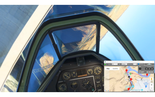
This flight is a canyon blast from the Glen Canyon Dam to Lake Meade at the far west end of the Grand Canyon. Altitudes are set at the rim of the canyon for the entire duration.
KPGA-KL24 Glen Canyon Dam to Lake Meade
P51-D Mustang Asobo Reno
READY: GET READY
START: [2.13 NM] START TIMING
T01: [1.01 NM] GLEN CANYON DAM BRIDGE
T02: [1.02 NM] GLEN CANYON DAM OVERLOOK
T03: [2.36 NM] PETROGLYPHS
T04: [1.14 NM] HORSESHOE BEND
T05: [1.21 NM] 6 MILE CAMPS
T06: [1.92 NM] FALL CREEK
T07: [1.80 NM] LEES FERRY
T08: [2.82 NM] NAVAJO BRIDGE
T09: [10.50 NM] RIDER POINT
T10: [11.40 NM] REDWALL CAVERN
T11: [5.21 NM] TAHATSO POINT
T12: [1.74 NM] POINT HANSBROUGH
T13: [2.05 NM] SADDLE CANYON
T14: [9.83 NM] SIXTYMILE CREEK
T15: [6.82 NM] BEAMER TRAIL
T16: [5.41 NM] RED CANYON
T17: [9.34 NM] BRIGHT ANGEL TRAIL BRIDGE
T18: [5.79 NM] HERMIT RAPIDS
T19: [5.39 NM] TURQUOISE CANYON
T20: [5.36 NM] SHINUMO FALLS
T21: [2.62 NM] WALTHENBERG CANYON
T22: [3.44 NM] ELVES CHASM
T23: [4.75 NM] FORSTER CANYON
T24: [6.65 NM] GALLOWAY CANYON
T25: [5.42 NM] FISHTAIL CANYON
T26: [4.33 NM] KANAB CANYON
T27: [3.62 NM] MATKATAMIBA CANYON
T28: [2.32 NM] BOYSAG POINT
T29: [1.27 NM] SINYELLA CANYON
T30: [3.90 NM] HAVASU CREEK
T31: [6.19 NM] FERN GLEN CANYON
T32: [12.06 NM] WHITMORE TRAIL
T33: [6.43 NM] HUNDRED AND NINETYTWO MILE CANYON
T34: [3.37 NM] PARASHANT WASH
T35: [3.57 NM] CAMP RM202
T36: [9.46 NM] THREE SPRINGS CANYON
T37: [9.06 NM] DIAMOND CREEK
T38: [6.63 NM] BRIDGE CANYON
T39: [6.52 NM] SEPARATION RAPIDS
T40: [2.30 NM] SPENCER CANYON
T41: [7.05 NM] DEVILS SLIDE RAPIDS
T42: [9.08 NM] GUANO POINT
T50: [2.86 NM] FINAL TURN
T51: [2.04 NM] FINISH TIMING
KL24: [7.35 NM] PEARCE FERRY AIRPORT
Total Distance: 226.76 NM
Flightplan by texstan
OFFICIAL TIMES
BEST [1] – 00:46:43
| WAYPOINT | LAP 1 |
| START | 5/26/2023 11:02:12 PM |
| T01 | 00:00:12 |
| T02 | 00:00:11 |
| T03 | 00:00:35 |
| T04 | 00:00:38 |
| T05 | 00:00:15 |
| T06 | 00:00:43 |
| T07 | 00:00:26 |
| T08 | 00:00:34 |
| T09 | 00:02:11 |
| T10 | 00:02:25 |
| T11 | 00:01:21 |
| T12 | 00:00:44 |
| T13 | 00:00:25 |
| T14 | 00:01:53 |
| T15 | 00:01:19 |
| T16 | 00:01:04 |
| T17 | 00:01:53 |
| T18 | 00:01:13 |
| T19 | 00:01:08 |
| T20 | 00:01:03 |
| T21 | 00:00:36 |
| T22 | 00:00:44 |
| T23 | 00:01:05 |
| T24 | 00:01:20 |
| T25 | 00:01:05 |
| T26 | 00:00:50 |
| T27 | 00:00:42 |
| T28 | 00:00:38 |
| T29 | 00:00:16 |
| T30 | 00:01:00 |
| T31 | 00:01:23 |
| T32 | 00:02:26 |
| T33 | 00:01:29 |
| T34 | 00:00:42 |
| T35 | 00:00:48 |
| T36 | 00:01:57 |
| T37 | 00:01:56 |
| T38 | 00:01:19 |
| T39 | 00:01:16 |
| T40 | 00:00:30 |
| T41 | 00:01:35 |
| T42 | 00:01:58 |
| T50 | 00:00:31 |
| T51 | 00:00:24 |
| LAP TIME | 00:46:43 |
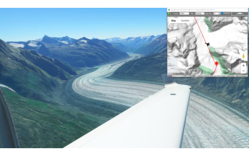
This is the penultimate leg of the Pacific Northwest series. It starts in Valdez, AK winds north over the glaciers and mountain lakes to a scenic landing at Sheep Mountain Airstrip in Glacier View.
PAVD-PASP Valdez to Sheep Mt Airstrip
DA40-NG Asobo
PAVD: VALDEZ AIRPORT
USR01: [7.31 NM] VALDEZ GLACIER
USR02: [23.21 NM] ICEBERG LAKE
USR03: [17.47 NM] TAZLINA LAKE
USR04: [21.43 NM] LONG LAKE
PASP: [8.18 NM] SHEEP MOUNTAIN AIRSTRIP
Total Distance: 77.62 NM
Flightplan by texstan

This is the third leg of our Lord of the Rings series, but with the recent MSFS World Update XII I’ve added some World Map POIs. This one starts at Auckland and leads south to the site of Hobbiton where a number of the Lord of the Rings movies were made which is now also a MSFS POI. There’s also now a Buddhist temple and geothermal power station on the route.
This is the flight plan used in the YouTube video https://youtu.be/bUjBhLqOn_g
NZAA-NZRO Auckland Airport to Rotorua
Asobo NXCub
NZAA: AUCKLAND AIRPORT
POI01: [7.59 NM] FO GUANG SHAN BUDDHIST TEMPLE
WP1: [17.00 NM] MANGATANGI RESEVOIR
WP2: [19.72 NM] LAKE WAIKARE
POI02: [6.86 NM] HUNTLY POWER STATION
LR1: [31.42 NM] LOTR – HOBBITON
WP3: [11.77 NM] KAIMAI MAMAKU LOOKOUT
POI03: [23.42 NM] HELLS GATE
NZRO: [3.54 NM] ROTORUA REGIONAL AIRPORT
Total Distance: 121.36 NM
Flightplan by texstan

Check out my lap times!
LEVC – Valencia Spain
Asobo NXCub
LEVC: VALENCIA AIRPORT
START: [6.76 NM] START LINE
TURN1: [0.33 NM] BLEACHER BEND
TURN2: [0.31 NM] HAIRPIN
FINISH: [0.51 NM] FINISH LINE
LEVC: [6.68 NM] VALENCIA AIRPORT
Total Distance: 14.60 NM
Flightplan by texstan
OFFICIAL TIMES
| WAYPOINT | LAP 1 | LAP 2 | LAP 3 | LAP 4 | LAP 5 |
| START | 5/16/2023 4:01:56 PM |
5/16/2023 4:02:48 PM |
5/16/2023 4:03:40 PM |
5/16/2023 4:04:30 PM |
5/16/2023 4:05:21 PM |
| TURN1 | 00:00:12 | 00:00:14 | 00:00:13 | 00:00:13 | 00:00:13 |
| TURN2 | 00:00:13 | 00:00:11 | 00:00:11 | 00:00:11 | 00:00:12 |
| FINISH | 00:00:19 | 00:00:19 | 00:00:18 | 00:00:19 | 00:00:19 |
| LAP TIME | 00:00:44 | 00:00:44 | 00:00:42 | 00:00:43 | 00:00:44 |

UT03 to Petrified Dunes Canyon Blast
P51-D Mustang Asobo Reno
UT03: HITE AIRSTRIP
TURN-1: [4.08 NM] START
TURN-2: [1.31 NM] HAIRPIN N
TURN-3: [1.64 NM] CO RIVER E
TURN-4: [2.88 NM] CO RIVER N
TURN-5: [3.01 NM] CO RIVER NE
TURN 6: [4.42 NM] S-TURN ENTRY
TURN-7: [2.74 NM] HAIRPIN
TURN-8: [1.57 NM] S-TURN EXIT
TURN-9: [6.32 NM] CHICANE ENTRY
TURN-10: [0.85 NM] APEX
TURN-11: [3.64 NM] CO RIVER N
TURN-12: [1.23 NM] CO RIVER NNE
TURN-13: [2.36 NM] GREEN RIVER CONFLUENCE
TURN-14: [3.70 NM] S TURN ENTRY
TURN-15: [1.50 NM] HAIRPIN 1
TURN-16: [1.88 NM] HAIRPIN 2
TURN-17: [1.44 NM] CO RIVER NNE
TURN-18: [2.51 NM] SHEEP BOTTOM
TURN-19: [2.30 NM] CO RIVER N
TURN-20: [7.22 NM] CO RIVER NW
TURN-21: [2.34 NM] HAIRPIN
TURN-22: [4.17 NM] CO RIVER N
TURN-23: [6.57 NM] S TURN ENTRY
TURN-24: [2.02 NM] HAIRPIN 1
TURN-25: [3.24 NM] HAIRPIN 2
FINISH: [2.94 NM] FINISH
EXIT: [5.29 NM] PETRIFIED DUNES
Total Distance: 83.29 NM
Flightplan by texstan
OFFICIAL TIMES
| WAYPOINT | LAP 1 |
| TURN-1 | 5/12/2023 11:30:41 AM |
| TURN-2 | 00:00:23 |
| TURN-3 | 00:00:19 |
| TURN-4 | 00:00:32 |
| TURN-5 | 00:00:33 |
| TURN 6 | 00:00:50 |
| TURN-8 | 00:03:28 |
| TURN-9 | 00:01:15 |
| TURN-10 | 00:00:10 |
| TURN-11 | 00:00:43 |
| TURN-14 | 00:07:04 |
| TURN-15 | 00:00:20 |
| TURN-16 | 00:00:30 |
| TURN-17 | 00:00:17 |
| TURN-18 | 00:00:38 |
| TURN-19 | 00:00:32 |
| TURN-21 | 00:11:47 |
| TURN-22 | 00:01:14 |
| TURN-23 | 00:01:21 |
| TURN-24 | 00:00:29 |
| TURN-25 | 00:00:40 |
| FINISH | 00:00:33 |
| LAP TIME | 00:16:04 |
This flight is a canyon blast from the Glen Canyon Dam to Lake Meade at the west end of the Grand Canyon. This flight plan uses the Extra 330 from the Standard version of MSFS instead of the Reno P51.
KPGA-KL24 Page Municipal to Pearce Ferry Airport
Extra 330 Asobo
KPGA: PAGE MUNICIPAL AIRPORT
T01: [2.94 NM] THE CHAINS
T02: [1.74 NM] GLEN CANYON DAM OVERLOOK
T03: [3.09 NM] PETROGLYPHS
T04: [0.98 NM] HORSESHOE BEND
T05: [2.51 NM] 6 MILE CAMPS
T06: [2.00 NM] WATERHOLE CANYON
T07: [2.18 NM] LEES FERRY
T08: [3.75 NM] NAVAJO BRIDGE
T09: [9.39 NM] COLORADO RIVER S
T10: [11.99 NM] REDWALL CAVERN
T11: [3.44 NM] COLORADO RIVER SW
T12: [4.07 NM] S-TURN ENTRY
T13: [1.99 NM] S TURN EXIT
T14: [2.74 NM] COLORADO RIVER SE
T15: [11.24 NM] COLORADO RIVER SSW
T16: [5.93 NM] BEAMER TRAIL
T17: [5.37 NM] COLORADO RIVER W
T18: [9.04 NM] BLACK BRIDGE / BRIGHT ANGEL TRAIL BRIDGE
T19: [6.57 NM] HERMIT RAPIDS
T20: [5.26 NM] COLORADO RIVER N
T21: [5.20 NM] SHINUMO FALLS
T22: [2.69 NM] COLORADO RIVER SSW
T23: [2.44 NM] ROYAL ARCHES W
T24: [1.31 NM] ROYAL ARCHES
T25: [2.26 NM] COLORADO RIVER W
T26: [3.30 NM] COLORADO RIVER NNE
T27: [6.70 NM] COLORADO RIVER NNW
T28: [5.16 NM] DEER CREEK TRAIL
T29: [4.74 NM] COLORADO RIVER S
T30: [3.70 NM] S-TURN ENTRY
T31: [1.28 NM] S-TURN ENTRY
T32: [1.68 NM] S-TURN APEX
T33: [1.39 NM] S-TURN EXIT
T34: [2.19 NM] HAVASU CREEK CONFLUENCE
T35: [4.17 NM] COLORADO RIVER SW
T36: [16.05 NM] COLORADO RIVER SW
T37: [2.97 NM] WHITMORE TRAILHEAD
T38: [3.48 NM] COLORADO RIVER W
T39: [4.65 NM] COLORADO RIVER SSW
T40: [3.89 NM] COLORADO RIVER S
T41: [9.33 NM] PUMPKIN SPRING ROCK
T42: [5.27 NM] CAMP RM221
T43: [3.38 NM] DIAMOND CREEK
T44: [2.31 NM] TRAVERTINE CANYON FALLS
T45: [4.21 NM] COLORADO RIVER NW
T46: [6.73 NM] COLORADO RIVER SW
T47: [2.57 NM] COLORADO RIVER NW
T48: [4.57 NM] COLORADO RIVER NW
T49: [11.32 NM] GUANO POINT
T50: [4.34 NM] CANYON EXIT
T51: [8.12 NM] APPROACH
KL24: [4.93 NM] PEARCE FERRY AIRPORT
Total Distance: 242.84 NM
Flightplan by texstan