
Flight Plan Series
Download and fly as many flight plans as you like! Just download and unzip the flight plan files and open them in Microsoft Flight Simulator – World Map, or use Simflightplan™ to change your aircraft, modify waypoints or create your own flight plans and share them here. Happy Flying!
Check out the Frequently Asked Questions page or our YouTube Channel.
You can search for specific flight plans by city/place names or ICAO code or even by author name to find your own or your friends flight plans.
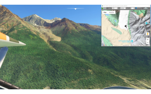
PAMX-PACV Bonanza Copper Mine Route 1909-38
Pilatus PC-6 Gauge Skis
This flight plan follows the route the copper had to follow from the famous Bonanza Mine in Alaska to the Pacific Coast. The Bonanza Ridge vein was one of the largest copper deposits ever discovered but it’s remote nature required a nearly 200 mile steam train route through the Alaskan outback, parts of which are still visible from the air.
PAMX: MCCARTHY AIRPORT
USR01: [23.57 NM] GILAHINA TRESTLE
USR02: [20.53 NM] CHITNA BRIDGE
USR03: [52.14 NM] MILLION DOLLAR BRIDGE
USR04: [16.87 NM] FLAG POINT
USR05: [20.92 NM] CORDOVA PORT
PACV: [9.13 NM] MERLE K (MUDHOLE) SMITH AIRPORT
Total Distance: 143.19 NM
Flightplan by texstan
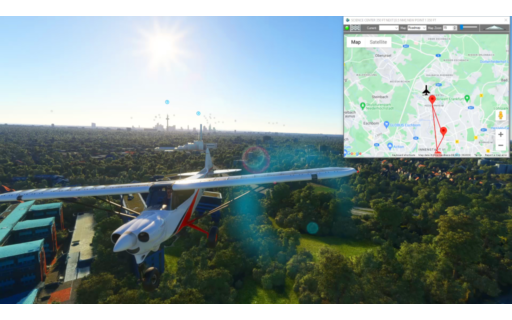
EDDF-EDDF Frankfort Local
Asobo NXCub
Sightseeing flight plan including Deutsche Bank Park and the Europaturm Tower in Frankfort. There are many bridges and other MSFS Points of Interest to see in Frankfort beyond what is on this flight plan. If you are trying to earn the Lanmarks The Spot Achievement in MSFS this is a good place to get many of them. To earn the achievement you must be within 550 feet of the Landmark and use the Smart Cam for 3 seconds. This is the flight plan used in the video https://youtu.be/CmFZViChwJA
EDDF: FRANKFORT AIRPORT
POI01: [5.98 NM] DEUTSCHE BANK PARK
POI02: [3.41 NM] MULTI BRIDGE RUN
POI03: [2.49 NM] SCIENCE CENTER
POI04: [1.23 NM] EUROPATURM TOWER
POI05: [1.74 NM] INCINERATOR PLANT
EDDF: [8.09 NM] FRANKFORT AIRPORT
Total Distance: 22.98 NM
Flightplan by texstan

Chicago Midway Intl to MC COOL
REDWING FARMAN F.60 US-MAIL
KMDW: KMDW
TIMECLI: [3.03 NM] TIMECLIMB
TIMECRU: [13.46 NM] TIMECRUIS
TIMEDSC: [3.31 NM] TIMEDSCNT
TIMEVER: [15.86 NM] TIMEVERT
KCO1: KCO1
Total Distance: 35.68 NM
Flightplan by PatrickStar
Chicago Midway Intl to MC COOL
REDWING FARMAN F.60 US-MAIL
KMDW: KMDW
TIMECLI: [3.03 NM] TIMECLIMB
TIMECRU: [13.46 NM] TIMECRUIS
TIMEDSC: [3.31 NM] TIMEDSCNT
TIMEVER: [15.86 NM] TIMEVERT
KCO1: KCO1
Total Distance: 35.68 NM
Flightplan by PatrickStar
Base Aérea de Kjeller to Leknes
Airbus A320 Neo Asobo
ENKJ: ENKJ
TIMECLI: [2.70 NM] TIMECLIMB
#: [79.02 NM] Rjukan-Notodden Industrial Heritage Site
ENBR: [101.19 NM] Flesland
#: [31.61 NM] Fyksesund Bridge
#: [17.49 NM] Hardanger Bridge
#: [28.13 NM] Stegastein Viewpoint
#: [23.57 NM] Urnes Stave Church
TIMECRU: [59.99 NM] TIMECRUIS
#: [15.03 NM] Ålesund – Gaviotas
#: [43.77 NM] Storseisundet Bridge
#: [11.90 NM] Gjemnessund Bridge
#: [75.78 NM] Lerkendal Stadion
TIMEDSC: [23.01 NM] TIMEDSCNT
#: [6.99 NM] Kjeungskjær Lighthouse
#: [16.64 NM] SalMar Ocean Farm 1
#: [155.18 NM] Helgeland Bridge
ENBO: [83.57 NM] Bodo
#: [53.42 NM] Skrova Lighthouse
ENLK: [23.13 NM] ENLK
Total Distance: 852.21 NM
Flightplan by JOSEMIX
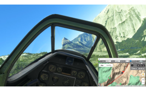
Improved Yosemite Canyon Blast
P51-D Mustang Asobo Reno
This is an improved version of the Yosemite Timed Run – originallly based on the Yosemite Bush Trip. The waypoints have been adjusted to be centered in the narrowest parts of the canyon, or directly over a portion of river or road. The route has been improved to follow the lowest portion of the canyon/valley for most of the way. Altitudes have been adjusted to give a fairly consistant 600 feet above ground elevations.
READY: GET READY
START: [4.69 NM] START TIMING
T01: [2.40 NM] TIOGA PASS ENTRACE
T02: [2.64 NM] VALLEY VIEW
T03: [0.89 NM] ELLERY LAKE
T04: [2.59 NM] MONO PASS
T05: [4.14 NM] LEMBERT DOME
T06: [2.77 NM] FAIRVIEW DOME
T07: [2.47 NM] TENAYA LAKE
T08: [3.91 NM] PYWIACK CASCADE
T09: [4.21 NM] TENAYA CANYON
T10: [1.57 NM] MERCED RIVER
T11: [2.24 NM] DEVILS ELBOW
T12: [3.95 NM] CASCADES
T13: [2.98 NM] MERCED GORGE
T14: [3.46 NM] EL PORTAL
T15: [3.86 NM] FERGUSON RIDGE
T16: [4.69 NM] BRICEBURG
T17: [1.78 NM] MCCABE FLAT
T18: [2.00 NM] RAILROAD FLAT
FINISH: [2.78 NM] FINISH TIMING
END: [1.59 NM] END
Total Distance: 61.72 NM
Flightplan by texstan
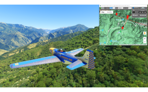
Sequoia National Park
P51-D Mustang Asobo Reno
This is a race course in the Kings Canyon National Park, in the southern Sequioia National Forest.
This is the flight plan used in the YouTube video https://youtu.be/sWh3BRb7rJs
READY: GET READY
START: [2.74 NM] KINGS RIVER SOUTH FORK
T1: [5.11 NM] MIDDLE FORK KINGS RIVER
T2: [4.85 NM] LOST CANYON
T3: [6.71 NM] WINDY CANYON
T4: [3.00 NM] PALISADE CREEK
T5: [4.10 NM] PALISADE LAKE
T6: [2.26 NM] MATHER PASS
T7: [3.17 NM] TABOOSE PASS
T8: [5.74 NM] MURO BLANCO
T9: [2.76 NM] WOODS CREEK
T10: [4.92 NM] BAILEY BRIDGE
T11: [9.20 NM] GRIZZLY FALLS
FINISH: [6.42 NM] LOCKWOOD CREEK
DONE: [2.45 NM] DONE RACING
Total Distance: 63.49 NM
Flightplan by texstan
Castillion Landing Practice
DA40-NG Asobo
This landing practice is for Castillion air field in France. It is the first landing after entering the Pyrenees mountains on the Mont Blanc Bush Trip. This flight plan includes 5 waypionts at the appropriate 3° glide slope every 2000 feet to the threshold of the runway (such as it is).
*Note: You will probably want to set the Lap Timer Distance Mode to Fixed and set a reasonable distance to each waypoint (ex 200 feet). In normal mode at landing speeds the Normal mode waypoint will be less than 100 feet.
START: START FLIGHT CRUISE
GS01: [1.87 NM] GLIDE SLOPE 10000 FT FROM THRESHOLD
GS02: [0.33 NM] GLIDE SLOPE 8000 FT FROM THRESHOLD
GS03: [0.32 NM] GLIDE SLOPE 6000 FT FROM THRESHOLD
GS04: [0.33 NM] GLIDE SLOPE 4000 FT FROM THRESHOLD
GS05: [0.32 NM] GLIDE SLOPE 2000 FT FROM THRESHOLD
RW1: [0.32 NM] RUNWAY THRESHOLD
FINISH: [0.13 NM] PARKED
LFMB: [0.20 NM] CASTILLION AIR FIELD
Total Distance: 3.85 NM
Flightplan by texstan
Runway 21 Glide Slope
Asobo NXCub
This is a landing practice for Sedona Airport runway 21. There are 5 glide slope waypoints 2000 feet apart at the correct altitude for a 3° glide slope.
*Note: You will probably want to set the Lap Timer Distance Mode to Fixed and set a reasonable distance to each waypoint (ex 200 feet). In normal mode at landing speeds the Normal mode waypoint will be less than 100 feet.
READY: READY FLIGHT CRUISE
GS01: [1.82 NM] GLIDE SLOPE 9000 FEET TO THRESHOLD
GS02: [0.33 NM] GLIDE SLOPE 7000 FT TO THRESHOLD
GS03: [0.33 NM] GLIDE SLOPE 5000 FT TO THRESHOLD
GS04: [0.32 NM] GLIDE SLOPE 3000 FT TO THRESHOLD
GS05: [0.32 NM] GLIDE SLOPE 1000 FT TO THRESHOLD
RW1: [0.36 NM] RUNWAY 21 AIMING POINT
RW2: [0.23 NM] RUNWAY 21 CENTER
TNG: [0.42 NM] TOUCH AND GO
KSEZ: [0.30 NM] SEDONA AIRPORT
Total Distance: 4.48 NM
Flightplan by texstan
Cincinnati/Northern Ky Intl to Roanoke-Blacksburg Rgnl/Woodru
DA62 Asobo
KCVG: KCVG
TIMECLI: [2.31 NM] TIMECLIMB
TIMECRU: [97.51 NM] TIMECRUIS
TIMEDSC: [48.76 NM] TIMEDSCNT
TIMEAPP: [101.34 NM] TIMEAPPROACH
KROA: [3.52 NM] KROA
Total Distance: 253.47 NM
Flightplan by sadkins77