
Flight Plan Series
Download and fly as many flight plans as you like! Just download and unzip the flight plan files and open them in Microsoft Flight Simulator – World Map, or use Simflightplan™ to change your aircraft, modify waypoints or create your own flight plans and share them here. Happy Flying!
Check out the Frequently Asked Questions page or our YouTube Channel.
You can search for specific flight plans by city/place names or ICAO code or even by author name to find your own or your friends flight plans.

This flight plan includes just the last waypoint before the LFMB (Castillion) landing from the France Bush Trip and the airstrip itself. The aircraft will spawn in flight over the waypoint previous to LFMB (Luz-Saint-Sauveur) so that you can easily restart as many times as you like if you want to practice the landing.
Note: I use the DA40-NGX Improvement Mod which makes the DA40 much easier to fly – you can check it out at https://flightsim.to/file/2738/da40-ngx-project. Thank you to mrtommymxr for the excellent mod.
LANDING PRACTICE
DA40-NG Asobo
POI31: LUZ-SAINT-SAUVEUR
LFMB: [4.88 NM] CASTILLION
Total Distance: 4.88 NM

This flight plan starts at Andahuayla Airport at 3,600′ as you gradually climb through the Andes to the peak of Padreyoc Mountain at nearly 20,000′. From there you can gently descend into the valley that cradles Machu Picchu at it’s center. This flight plan then takes you southeast to Cusco passing the Inti Punku Sun Gate, Ollantaytambo, Pumamarca and Moray before passing over Saqsaywaman and landing at Cusco Int’l.
For the best experience, check out the Scenery mod at https://flightsim.to/file/14281/machu-picchu
Special thanks to MSFSItalia!
SPHY-SPZO Andahuaylas to Cusco
Pilatus PC-6 G950 Wheels
SPHY: ANDAHUAYLAS
WP1: [40.96 NM] PADREYOC MOUNTAIN
WP2: [17.15 NM] MACHU PICCHU
WP3: [14.44 NM] INTI PUNKU SUN GATE
WP4: [2.79 NM] OLLANTAYTAMBO / TEMPLO DEL SOL
WP5: [5.83 NM] MORAY
WP6: [16.57 NM] SAQSAYWAMAN
WP7: [0.40 NM] CATEDRAL del CUZCO
SPZO: [2.55 NM] CUSCO INTERNATIONAL AIRPORT
Total Distance: 100.71 NM

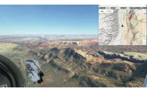
This is leg 5 of a multi-leg flight from Crownpoint, NM to Moab, UT across the vast Navajo Volcanic Field. Take off from Hite Airstrip along the Colorado River and hug the river as you fly north through deep canyons of the Canyonlands Nat’l Park to Arches Nat’l Park to see how many arches you can find.
This is the flight plan used in the YouTube video https://youtu.be/h09U-RjnY1g
Note: In the video the DA40-NGX Improvement Mod has been used which makes the DA40 much easier to fly – you can check it out at https://flightsim.to/file/2738/da40-ngx-project
Thank you to mrtommymxr for the excellent mod.
UT03 to KCNY Hite to Canyonlands
DA40-NG Asobo
UT03: HITE AIRSTRIP
WP1: [9.06 NM] ROCKFALL CANYON
WP2: [8.13 NM] GYPSUM CANYONWP1:
WP3: [7.18 NM] THE NEEDLES CANYON
WP4: [4.61 NM] SPANISH BOTTOM
WP5: [2.64 NM] COLORADO / GREEN RIVER CONFLUENCE
WP6: [4.60 NM] THE LOOP
WP7: [4.56 NM] SHEEP BOTTOM
WP8: [3.40 NM] LATHROP CANYON / AIRPORT TOWER
WP9: [5.25 NM] THELMA & LOUISE POINT / FIEDLER ARCH
WP10: [4.65 NM] SAFARI BEACH / ANTICLINE OVERLOOK
WP11: [4.30 NM] THE BILLBOARD / JUG HANDLE ARCH
WP12: [10.26 NM] ARCHES NAT’L PARK / BALANCED ROCK
WP13: [6.51 NM] DOUBLE O ARCH / LANDSCAPE ARCH
KCNY: [6.83 NM] CANYONLANDS FIELD AIRPORT
Total Distance: 82.06 NM
Note: In the video the DA40-NGX Improvement Mod has been used which makes the DA40 much easier to fly – you can check it out at https://flightsim.to/file/2738/da40-ngx-project
Thank you to mrtommymxr for the excellent mod.
This is actually just the LFMB-LFIP leg of the France/Mont Blanc Bush Trip but with the aircraft changed to the Pilatus PC-6, it’s a lot more fun to fly!
LFMB-LFIP Castillon to Peyresourde
Pilatus PC-6 G950 Wheels
LFMB: CASTILLON
WP1: [1.25 NM] CABANE DETS COUBOUS
WP2: [2.58 NM] LAC d’AUBERT
WP3: [2.56 NM] LAC DE I’OULE
WP4: [2.85 NM] ARAGNOUET
WP5: [4.31 NM] SAINT LARY-SOULAN
POI37: [5.66 NM] ARREAU
POI38: [5.97 NM] LAC DE GENOS
LFIP: [1.39 NM] PEYRESOURDE ALTIPORT
Total Distance: 26.61 NM

Shiprock Airstrip to Olijato Regional
DA40-NG Asobo
If you set the altitude hold to about 1000′ above the ground, you can let the Autopilot fly a pattern through the mesas in Monument Valley while you use the Drone to enjoy the view from outside the cockpit. This Flightplan is basically the same as leg 2 of the Navajo Volcanic Field series except for the addtional waypoints to fly through the mesas in Monument Valley.
5V5: SHIPROCK AIRSTRIP
POI09: [13.61 NM] HWY 64
POI10: [10.63 NM] AZ BORDER/PASTORA PEAK
POI11: [17.75 NM] WILLOW SPRING WASH
POI12: [10.51 NM] CHINLE CREEK
POI13: [8.04 NM] PASS IN THE RIDGE
POI14: [3.95 NM] ROOSTER ROCK
POI15: [7.12 NM] SENTINAL MESA/MONUMENT VALLEY
POI16: [3.04 NM] THE STAGECOACH
POI17: [5.76 NM] FORREST GUMP POINT
POI18: [7.07 NM] EAGLE MESA
POI19: [7.03 NM] TRAIN ROCK
UT25: [5.09 NM] OLJATO REGIONAL AIRPORT
Total Distance: 99.64 NM
Note: In the video the DA40-NGX Improvement Mod has been used which makes the DA40 much easier to fly – you can check it out at https://flightsim.to/file/2738/da40-ngx-project
Thank you to mrtommymxr for the excellent mod.
This is leg 4 of a multi-leg flight from Crownpoint, NM to Moab, UT across the vast Navajo Volcanic Field.
Take off from Page Municipal and fly over the Glen Canyon Dam and (if you dare) down into the canyon. Continue southwest over (or through) Horseshoe bend as you follow the Glen Canyon.
As you continue into the wider Marble Canyon you’ll change your course northwest over the historic Navajo Bridge.
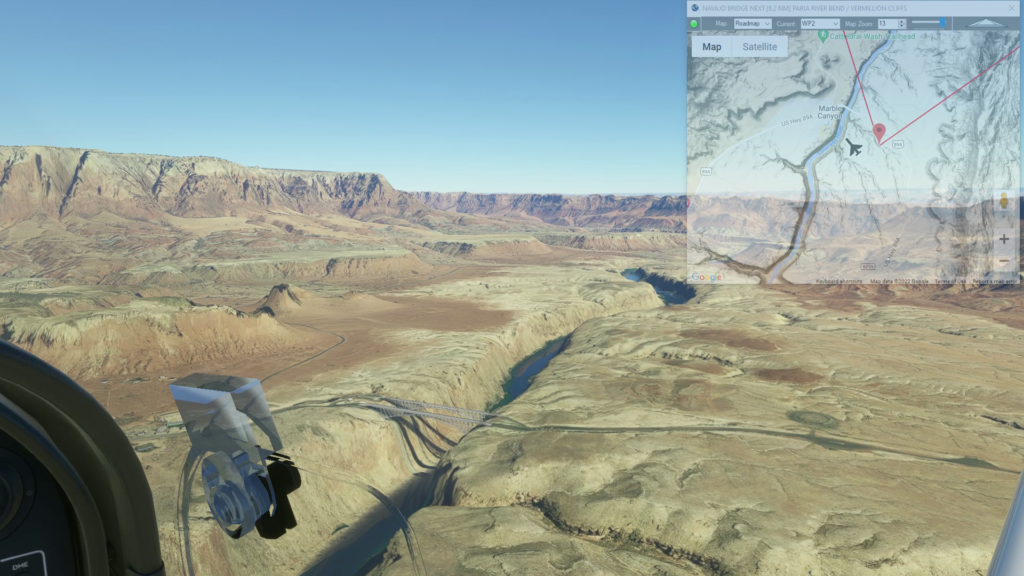
Climb out of the canyon and fly over the Vermillion Cliffs National Monument until you reach the Paria River bend.
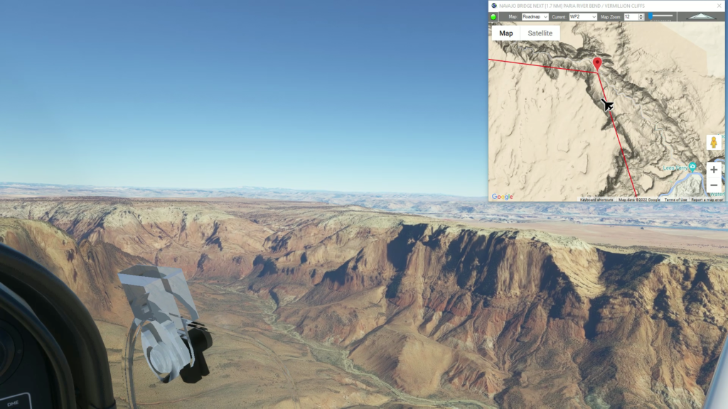
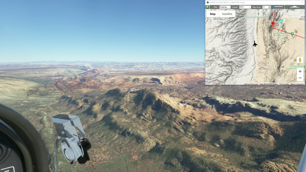
Adjust your course west to White Pocket.
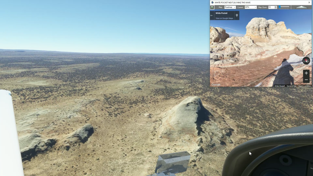
Then continue west to a rock formation called The Wave.
Follow the low canyon north until you reach Buckskin Gulch.
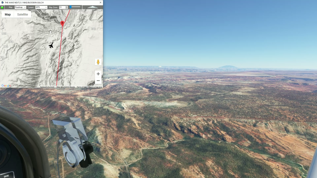
Continue to follow the low ridgeline north to Yellow Rock.
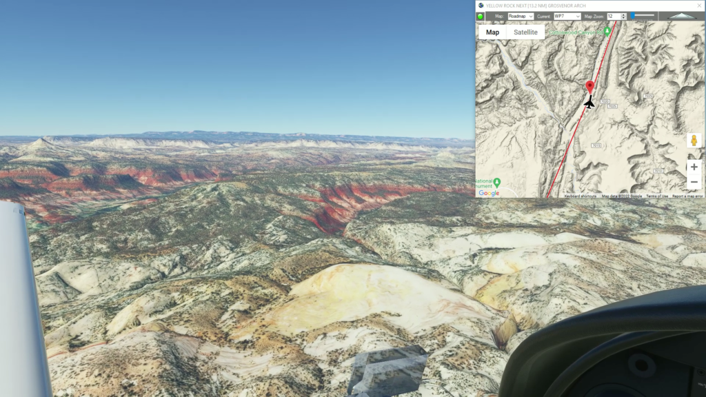
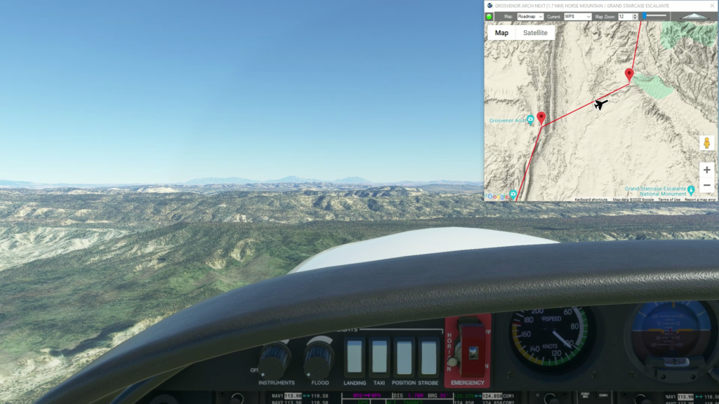
As you adjust your course east you’ll fly over Grand Staircase Escalante National Monument. If you gain some alititude you can see the distinct plateaus that make up the staircase as they descend into the the desert south of the Grand Canyon.
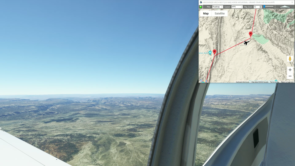
As you reach a Horse Mountain at the northern edge of the plateau adjust your course north.
Gently gain altitude as you continue north over Death Ridge.
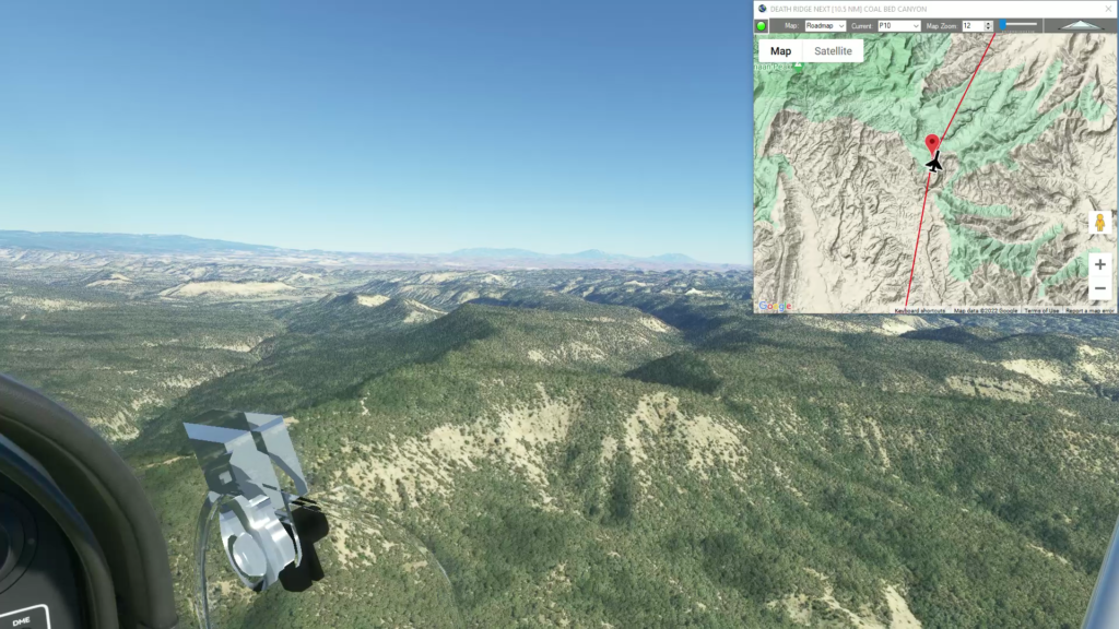
As you reach Coal Bed Canyon you will see Escalante, Utah come into view and begin your approach into Escalante Municipal.
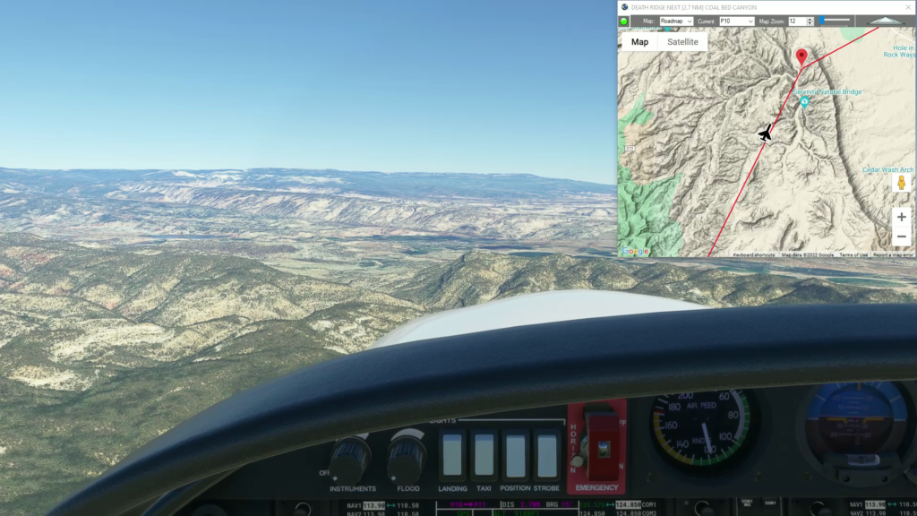
Land at Escalante Municipal Airport
To continue exploring the Navajo Volcanic Field, check out the other Navajo Volcanic Field Flightplans.
Note: In the video the DA40-NGX Improvement Mod has been used which makes the DA40 much easier to fly – you can check it out at https://flightsim.to/file/2738/da40-ngx-project
Thank you to mrtommymxr for the excellent mod.

This is leg 6 of a multi-leg flight from the Columbia River Gorge through the mountains and glaciers to Anchorage Alaska.
Take off from Bellingham Int’l Airport and follow US Interstate 5 nortwest to the US-Canada border.

As you cross into Canada, maintain your heading toward Surrey and the Frasier River.

Adjust your course westerly toward Vancouver and cross the harbor at the Burrard St and Granville bridges.

Explore the sights of Downtown Vancouver,

Make your way north to Vancouver Harbor.

Cross Vancouver Harbor and continue over North Vancouver.

Start gaining altitude as you climb over Capilano Lake and head into the mountains.

After a short distace, begin your decent over the Sea to Sky Gondola and start your approach into Squamish.

Fly over Squamish and land at Squamish Airport.

To continue exploring the Pacific Northwest checkout one of the other Pacific Northwest Flightplans.
Note: In the video the DA40-NGX Improvement Mod has been used which makes the DA40 much easier to fly – you can check it out at https://flightsim.to/file/2738/da40-ngx-project
Thank you to mrtommymxr for the excellent mod.

This is leg 5 of a multi-leg flight from the Columbia River Gorge through the mountains and glaciers to Anchorage Alaska.
I use the DA40-NGX Improvement Mod which makes the DA40 much easier to fly – you can check it out at https://flightsim.to/file/2738/da40-ngx-project. Thank you to mrtommymxr for the excellent mod
KPAE to KBLI Paine Field to Bellingham
DA40-NG Asobo
KPAE: PAINE FIELD
WP: [18.93 NM] CAMANO ISLAND
WP_1: [16.71 NM] BIG LAKE
KBLI: [27.70 NM] BELLINGHAM INT’L AIRPORT
Total Distance: 63.36 NM
Flightplan by texstan

This is leg 4 of a multi-leg flight from the Columbia River Gorge through the mountains and glaciers to Anchorage Alaska.
Take off from Pierce County Airport and head northwest over the flat plain leading to the Tacoma Narrows.
Continue northwest to the Tacoma Narrows Bridge, which is the site of the famous bridge collapse on November 7, 1940 of the prececessor to the current bridge.
Adjust your heading northeast and continue to Seattle.
You’ll fly past the famous Space Needle as you continue north of Seattle.
About 10-15NM north of Seattle begin your approach into Paine Field.
Land at Paine Field-Lake Stickney Airport.
To continue exploring the Pacific Northwest checkout the Bellingham, WA (Paine Field to Bellingham Int’l) Flightplan or one of the other Pacific Northwest Flightplans.
Note: In the video the DA40-NGX Improvement Mod has been used which makes the DA40 much easier to fly – you can check it out at https://flightsim.to/file/2738/da40-ngx-project
Thank you to mrtommymxr for the excellent mod.

This is leg 2 of a multi-leg flight from Crownpoint, NM to Moab, UT across the vast Navajo Volcanic Field.
Take off from Shiprock Airstrip and follow US-64 northwest toward the New Mexico and Arizona border.

Adjust your course west and gain altitude to fly over Pastora Peak as you cross into Arizona.

Set a course west across the desert toward a dark stain in the middle of the reddish brown desert. Descend as you make your way toward Willow Spring Wash and beyond that Chinle Creek.

As you make your way into Monument Valley Rooster Rock greets you before you bend north into the center of the valley.

Explore famous Mesas like the Stagecoach and find your way to Train Rock to begin your approach.

Land at Oljato Regional.
To continue exploring the Navajo Volcanic Field from Oljato Regional, check out the Glen Canyon (Monument Valley to Glen Canyon Dam) Flightplan or one of the other Navajo Volcanic Field flights.
Note: In the video the DA40-NGX Improvement Mod has been used which makes the DA40 much easier to fly – you can check it out at https://flightsim.to/file/2738/da40-ngx-project
Thank you to mrtommymxr for the excellent mod.