
You can use Flightplans Cockpit Map to take Google Maps in the cockpit with you in Microsoft Flight Simulator. You can open any MSFS flight plan and follow your progress on the flight path or just use the Google Map to create a route on-the-fly. Check out the video below for an overview of Cockpit…
Bush Trip
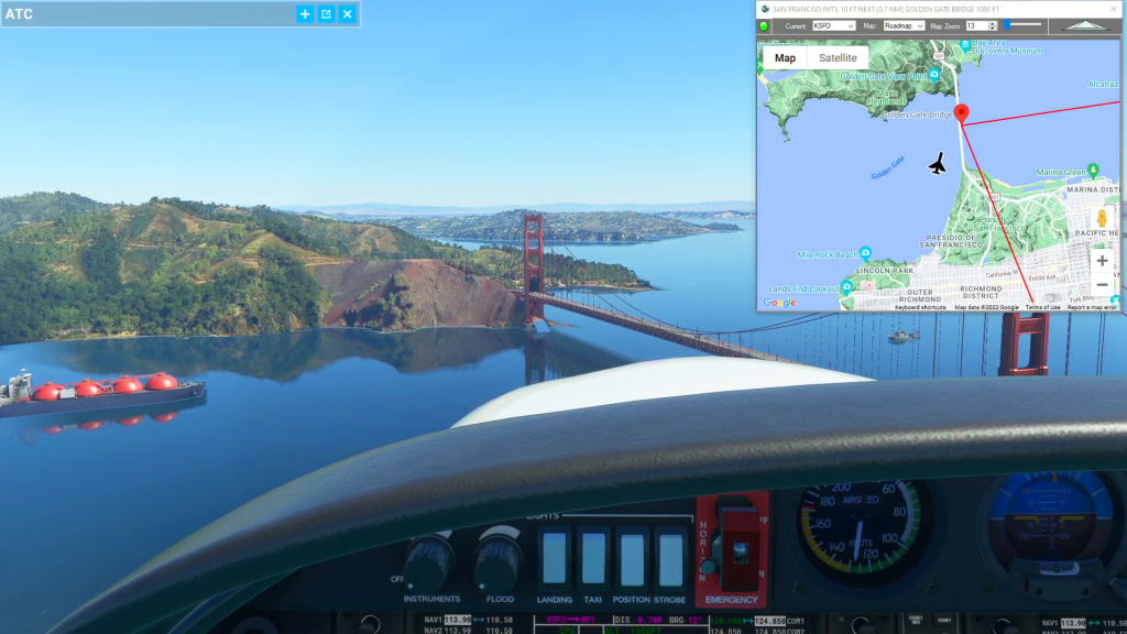
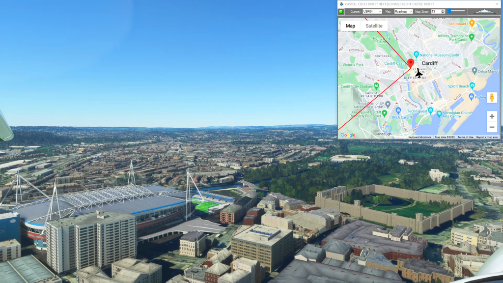
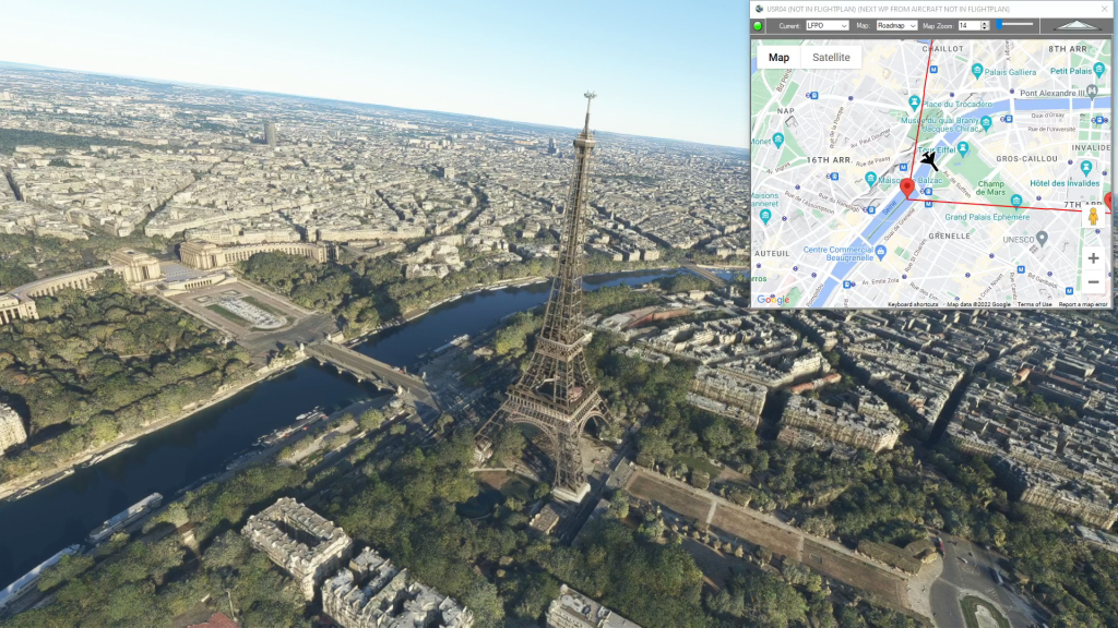
Simflightplan™ is a Google Maps flight planning add-on for use with Microsoft Flight Simulator. You can use Cockpit Map to take Google Maps in the cockpit with you to use real time terrain elevations, road maps, landmarks, satellite views and street view 3D imagery.
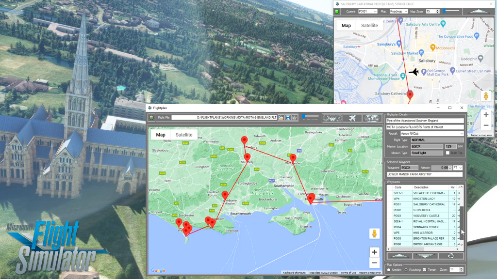
Download Simflightplan™ and try it yourself – the link is at the bottom of the page. You can also download and fly any of our free flight plans below, or click the Downloads link at the top to search all downloads. Load them in MSFS World Map and you are ready to fly. For more information see the FAQ page or our YouTube channel.
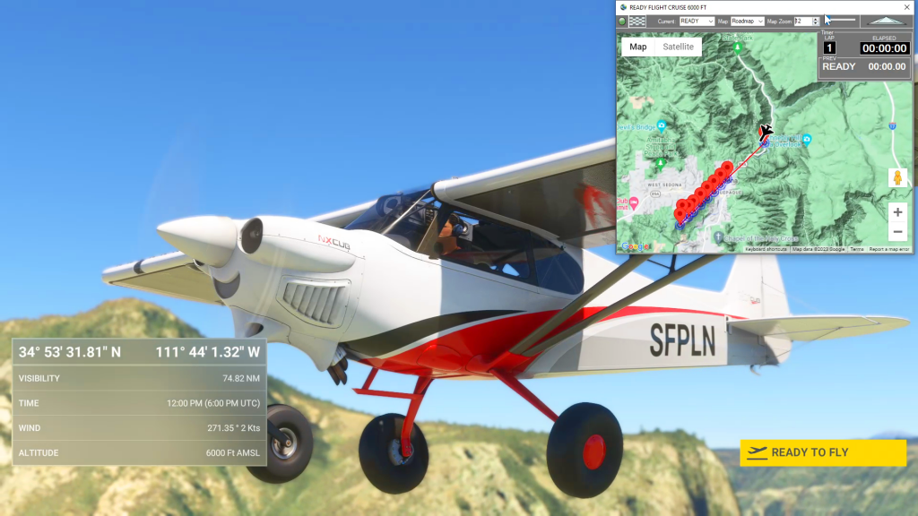
Navigating Microsoft Flight Simulator Bush Trips can be a challenge. You can use the Nav Log bearings and ETEs to navigate the route, but if you want to sight-see the compass and stopwatch can be a burden. You can use the VFR Map, but it doesn’t show town or street names and the elevations are difficult to read. Wouldn’t it be nice to have Google maps in the cockpit with you?
Happy Flying!
How To Create an MSFS Landing Practice
Using Simflightplan™, you can easily create a planned approach for any airport (or glacier, lake, etc.). Using the Lap Timer, Cockpit Map will record your progress along the flight path, but only if you are under the assigned altitude. The video shows examples at Sedona and Castillion. The key to creating an accurate landing practice…
How To Create A Flight Plan in MSFS
There are several ways to copy and save flight plans to create a new flight plan (Check out the videos on our YouTube channel link below). There is not currently a specific New button in Flightplan to create a file from scratch. The primary reason for this is that the values that define the aircraft,…
How do I use Google Maps in MSFS?
With Simflightplan™ for Flight Simulator, you can take Google Maps in the cockpit with you. Simflightplan™ Cockpit Map allows you to see the real-time google map beneath you as you fly. Just like on your phone, Google Maps will display road names, place names, landmarks, street views and 3D photogrammetry as you fly. You can…
What do the Google maps push pin icons mean?
It is surprisingly difficult to find a complete legend of all the map icons you might see on Google maps. Below is what was in a Google blog post from 2017 which corresponded with a feature release. This list is most probably not complete, but it was difficult enough to find that we decided to…