Skip to content
Menu
simflightplan icon
  • Home
  • Community
  • Downloads
  • Racing
  • FAQ
  • Profile
  • Support
simflightplan icon
Satellite View

How To Use Satellite View During Taxi

Posted on December 21, 2022

You can use the Satellite view of Cockpit Map to assist with navigating complicated taxiways. Simply turn on GPS Follow mode, set your Zoom level so that you can read the taxiway and runway markings (if the airport is clearly marked) and select Satellite as your Map. You can then follow the ATC taxi route using the actual taxiway markings as photgraphed by the satellite.

Check out the How To videos on our YouTube channel for more information https://youtube.com/@simflightplan
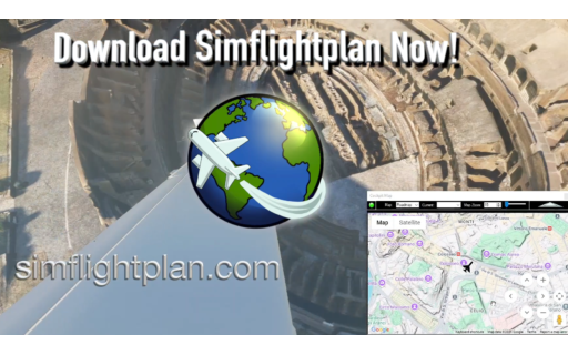
Flightplan for Flight Simulator

Flightplan for Flight Simulator

4.1
Rated 4.1 out of 5

Flightplan is a Google Maps flight planning add-on for use with Microsoft Flight Simulator 2020. Flightplan can be used to create and share your own flight plans using an interactive Google Maps drag-and-drop interface complete with terrain elevations, landmarks, streetviews, etc. Click on the interactive map to drop a pin at any location on earth, plus edit your aircraft and flight plan settings before you get in the cockpit.

Download Flightplan for Flight Simulator for free now!  Google Maps API subscription is included free for 2 weeks.

Flightplan is always free to use for editing and modifying flight plans, a Google Maps API subscription is required to continue using the map features.  Software updates and upgrades are free for life.

Note: Each PC can be registered to only 1 user, so please make sure you are using the same PC you run Microsoft Flight Simulator 2020 on when you open Flightplan for the first time.

  • Bush Trip
  • Bush Trips
  • Cockpit Map
  • Cockpit Map Features
  • Flight Plan Map
  • Flight Plan Microsoft Flight Simulator 2020
  • Flight Plan MSFS
  • Flight Plan MSFS 2020
  • Flight Plan Sim
  • Flight Plan Simulator
  • Flight Planner
  • Flight Planner Flight Sim
  • Flight Planner For Simulator
  • Flight Planner Google
  • Flight Planner MSFS
  • Flight Planner MSFS 2020
  • Flight Planner Sim
  • Flight Planner Simulator
  • Flight Planning
  • Flight Route Simulator
  • Flight Sim Flight Plan
  • Flight Sim Flight Planner
  • Flight Sim Planner
  • Flight Sim Planning
  • Flight Sim Planning Software
  • Flight Simulator
  • Flight Simulator 2020 Flight Planner
  • Flight Simulator Google
  • Flight Simulator Google Maps
  • Flight Simulator Live Map
  • Flight Simulator Map
  • Flight Simulator Map While Flying
  • Flight Simulator Maps
  • Flight Simulator Planner
  • Flight Simulator Route Planner Software
  • Flightplan MSFS
  • Glass Cockpit To Sim
  • Google
  • Google Flight Planner
  • Google Map Flight Simulator
  • Google Maps Flight Simulator
  • Google Maps Photogrammetry In MSFS 2020
  • Google Maps Simulator
  • GPS MSFS
  • How to use Google Maps in Cockpit
  • How To Use Google Maps in MSFS 2020
  • How To Use Satellite View During Taxi
  • Maps Flight Simulator
  • Microsoft Flight Simulator
  • Microsoft Flight Simulator Flight Planner
  • Microsoft Flight Simulator Google Maps
  • Microsoft Flight Simulator Map
  • Microsoft Flight Simulator Map While Flying
  • Microsoft Flight Simulator Maps
  • MSFS
  • MSFS 2020 Flight Plan
  • MSFS 2020 Flight Planner
  • MSFS 2020 Flight Plans
  • MSFS Flight Plan
  • MSFS Flight Planner
  • MSFS Flight Planning
  • MSFS Flight Plans
  • MSFS Google Maps
  • MSFS Map
  • MSFS Map While Flying
  • Sim Flight Plan
  • Sim Flight Planner
  • Sim Flight Planning
  • Simflight
  • Simulator Flight Planner
  • taxi
  • taxiway
YouTube Logo
Twitch Logo
Reddit Logo
Discord Logo
Download Flightplan Now
Frequently Asked Questions
Privacy Policy
©2025 Simflightplan
Don't have an account yet? Register Now