
You can add a new waypoint to your flight plan using latitude and longitude, but you must format the coordinate as follows: Which is as follows: The cardinal compass direction and degrees of latitude including the ° symbol (use Alt + 0176 on a Windows keyboard) then a space. Next are minutes with no decimal…
MSFS
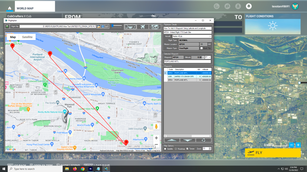
Flightplan is a flight planning add-on for use with Microsoft Flight Simulator 2020. Flightplan can be used to create and share your own flight plans using an interactive drag-and-drop interface complete with terrain elevations, landmarks, street views, etc.
Why does my map keep changing zoom level?
There are 2 sets of zoom controls in Flightplan. The Map Options section in the lower right of the main window contains the default zoom level (and other settings) that the map will revert to when the map is recentered. The map recenters anytime a waypoint is selected in the grid or a pushpin clicked…
Can I use the scroll-wheel on my mouse?
Since the scroll-wheel is used by MS Flight Simulator, Flightplan does not respond to the mouse scroll-wheel. The map can be zoomed using the +/- buttons on the map itself to zoom in/out temporarily, or the GPS Follow zoom level can be set using the “Map Zoom” field. This is the zoom level that map…
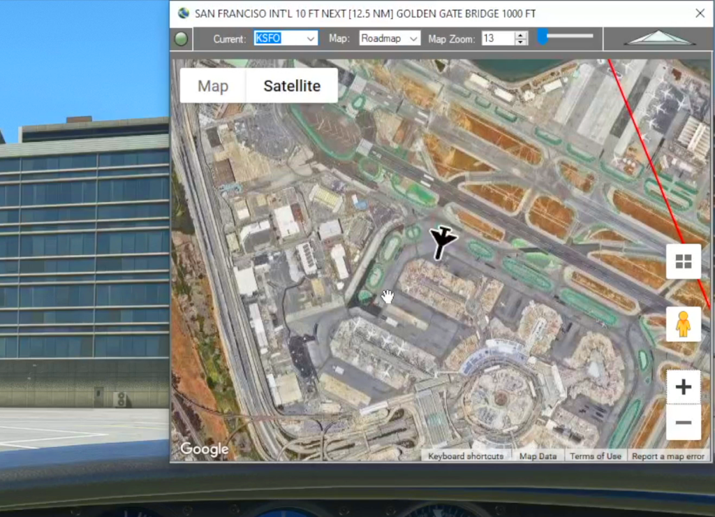
Cockpit Map
When in-flight during gameplay, the Cockpit Map can replace Nav Map to maintain a virtual GPS fix on your position and previous/next waypoints. It displays the path and distance to waypoints in the selected flight plan with real-time aircraft location and flight path. The floating Cockpit Map can be moved and resized and the transparency…

Google Maps Integration
Flightplan is a Google Maps flight planning add-on for use with Microsoft Flight Simulator 2020. Flightplan can be used to create and share your own flight plans using an interactive Google Maps drag-and-drop interface complete with terrain elevations, landmarks, streetviews, etc. Click on the interactive map to drop a pin at any location on earth,…