
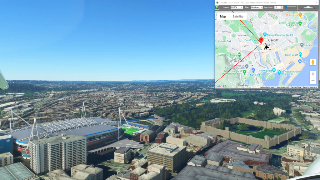
With Simflightplan™ for Flight Simulator, you can take Google Maps in the cockpit with you. Simflightplan™ Cockpit Map allows you to see the real-time google map beneath you as you fly. Just like on your phone, Google Maps will display road names, place names, landmarks, street views and 3D photogrammetry as you fly. You can…
Flight Plan Download
Simflightplan™ is a Google Maps flight planning add-on for use with Microsoft Flight Simulator. You can use Cockpit Map to take Google Maps in the cockpit with you to use real time terrain elevations, road maps, landmarks, satellite views and street view 3D imagery.
Download Simflightplan™ and try it yourself. You can also download and fly any of our free flight plans, click the Downloads link at the top to search all downloads. Load them in MSFS World Map and you are ready to fly.
For more information see the FAQ page or our YouTube channel.
Happy Flying!

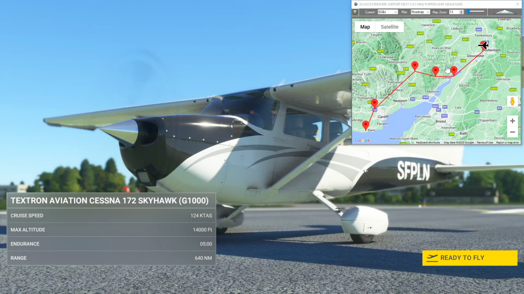
How To Download and Fly a Flight Plan in MSFS
All flight plans at https://simflightplan.com/download/ are free to fly for everyone. Just create a free account using the Register Now link at the bottom of the login page. Once you have an account, download as many flight plans as you want for as long as you want. If you want to upload your own flight…

How To Share A Flight Plan
You can share a flight plan at https://simflightplan.com/download/ by clicking the Share Button at the top (next to the Save Button). You have options to type an addtional summary, include the list of waypoints and distances, and post under your own simflightplan username if you want. You can also include a featured image if you…
How do I save the aircraft settings I want to start with?
While Flightplan allows you to change the aircraft name for any flight, there are many settings that may not be correct from one aircraft to another. Typically, changing from a “more complex” aircraft to a “less complex” aircraft (for example from an A320neo to a Cessna Skyhawk) will not have any noticable change when loading…