
Well yes, from a navigation perspective the point of Bush Trips is to use the Nav Log and VFR to navigate the route. Although some of the Nav Log descriptions are vague and hard to follow on a number of built-in Bush Trips so it can be difficult to find the landmarks mentioned (even if you know what you’re looking for). That said, you’d have access to any charts and elevation data you wanted to review before take off, so you could load any random flight plan just to use the Cockpit Map in flight – without loading the flight plan for the leg you are currently flying. This will give you the map with GPS Follow mode available to follow your progress and the regular street and landmark names from Google, but the route won’t be shown on the map unless you load the correct flight plan for the Bush Trip.
Ultimately the answer is up to you, Flightplan connects to Flight Simulator to load the real-time "GPS" data, but Flight Simulator has no way to recognize Flightplan so it will continue to give you credit for flying the leg even if you used Flightplans Cockpit Map in-flight. Flightplan doesn't allow you to edit or modify the in-game Bush Trip directly so you still have to fly every leg. You can save a copy of the Bush Trip and edit it to create your own flight plans to fly through World Map if you're having trouble completing a leg. But MS Flight Simulator won't recognize it as a Bush Trip leg, and will not give you credit (update the % complete). So whether you use Flightplan as a "crutch" or not, you will still have to fly every leg through the Bush Trip menu.
Check out the How To videos on our YouTube channel for more information https://youtube.com/@simflightplan

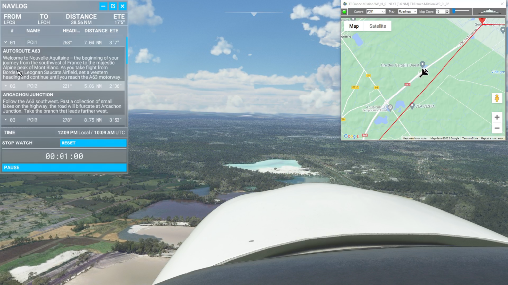
Simflightplan™ is a Google Maps flight planning add-on for use with Microsoft Flight Simulator. Simflightplan™ can be used to create and share your own flight plans using an interactive Google Maps drag-and-drop interface complete with terrain elevations, landmarks, streetviews, etc. Click on the interactive map to drop a pin at any location on earth, plus edit your aircraft and flight plan settings before you get in the cockpit.
Download Simflightplan™ for Flight Simulator for free now! Google Maps API subscription is included free for 7 days.
Simflightplan™ is always free to use for editing and modifying flight plans, a Google Maps API subscription is required to continue using the map features. Software updates and upgrades are free for life.
Note: Each PC can be registered to only 1 user, so please make sure you are using the same PC you run Microsoft Flight Simulator 2020 on when you open Simflightplan™ for the first time.