
When in-flight during gameplay, the Cockpit Map can replace Nav Map to maintain a virtual GPS fix on your position and previous/next waypoints. It displays the path and distance to waypoints in the selected flight plan with real-time aircraft location and flight path. The floating Cockpit Map can be moved and resized and the transparency…
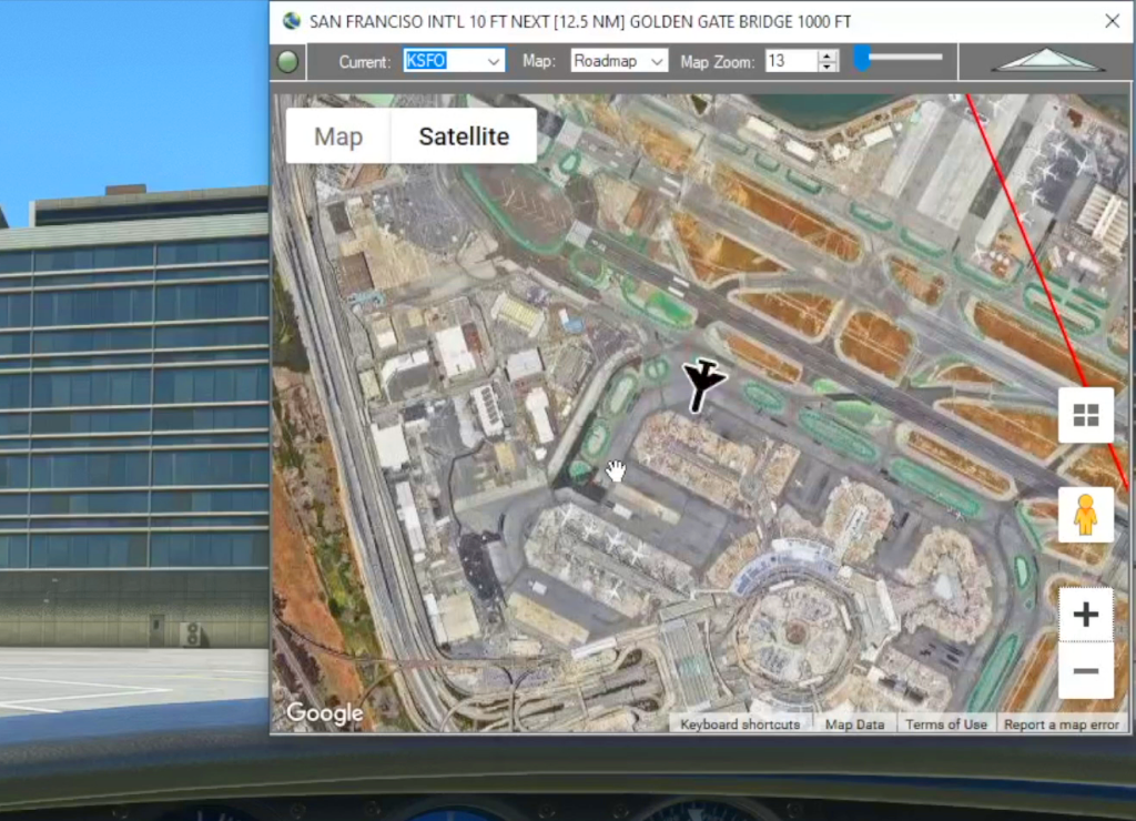
Google Map
Flightplan is a Google Maps flight planning add-on for use with Microsoft Flight Simulator 2020. You can use Cockpit Map to take Google Maps in the cockpit with you to use real time terrain elevations, road maps, landmarks, satellite views and street view 3D imagery. Flightplan can also be used to create and share your own flight plans using an interactive drag-and-drop, Google Maps interface. Download Flightplan yourself – the link is at the bottom of the page.

Google Maps Integration
Flightplan is a Google Maps flight planning add-on for use with Microsoft Flight Simulator 2020. Flightplan can be used to create and share your own flight plans using an interactive Google Maps drag-and-drop interface complete with terrain elevations, landmarks, streetviews, etc. Click on the interactive map to drop a pin at any location on earth,…