

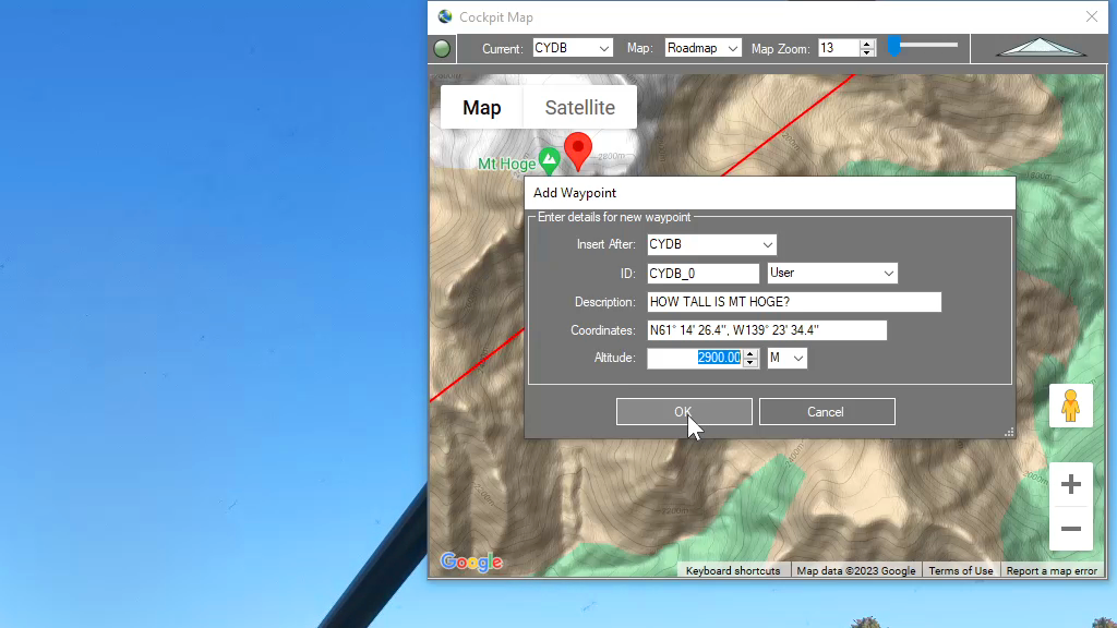
You can add a waypoint to a flight plan by clicking anywhere on the map. Flightplan will drop a push-pin at the coordinate you clicked, and open the Add Waypoint form (see below). You can update the waypoint ID which will show in the glass cockpit if your aircraft is so equipped. You can also…
Flight Simulator
Flightplan is a Google Maps flight planning add-on for use with Microsoft Flight Simulator 2020. You can use Cockpit Map to take Google Maps in the cockpit with you to use real time terrain elevations, road maps, landmarks, satellite views and street view 3D imagery. Flightplan can also be used to create and share your own flight plans using an interactive drag-and-drop, Google Maps interface.
Download Flightplan and try it yourself – the link is at the bottom of the page. You can also download and fly any of our free flight plans using the Download Link at the top. Load them in MSFS World Map and you are ready to fly. For more information see the topics below or check out our YouTube channel or FAQ page.
Happy Flying!
How can I quickly convert elevations from meters to feet in MSFS?
You can drop a pin anywhere and enter the desired altitude using either Meters (M) or Feet (FT) and when the Pin is added to the map it will be converted to your flight plan unit of measure. So if you are used to flying using Imperial units of measure (feet) but the local elevations…
How to create a custom airport?
To create a brand new airport, click anywhere on the airport grounds, at the location where you want your aircraft to spawn. Next, enter the appropriate ICAO code if there is one as your waypoint ID, the name of the airport as your description and select whatever altitude (elevation) you want. If you’re not certain…
How do I pick an aircraft that is not in the drop-down list?
Flightplan has a list of the aircraft that come with the Basic version of Microsoft Flight Simulator 2020 for convenience (future versions may contain addtional aircraft) but it would be impossible to keep the list in sync with every aircraft in the Marketplace. So the name of any aircraft you own can be typed into…

How To Use Satellite View During Taxi
You can use the Satellite view of Cockpit Map to assist with navigating complicated taxiways. Simply turn on GPS Follow mode, set your Zoom level so that you can read the taxiway and runway markings (if the airport is clearly marked) and select Satellite as your Map. You can then follow the ATC taxi route…