
Simflightplan 2 Now Available!
Sim Flight Plan
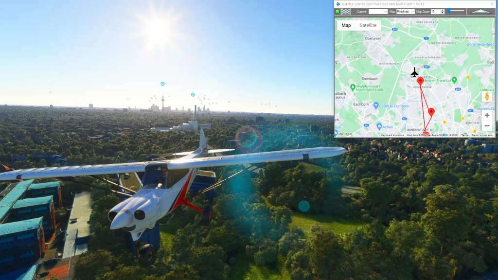
Flightplan is a Google Maps flight planning add-on for use with Microsoft Flight Simulator 2020. You can use Cockpit Map to take Google Maps in the cockpit with you to use real time terrain elevations, road maps, landmarks, satellite views and street view 3D imagery. Flightplan can also be used to create and share your own flight plans using an interactive drag-and-drop, Google Maps interface.
Download Flightplan and try it yourself – the link is at the bottom of the page.
You can also download and fly any of our free flight plans using the Download Link at the top. Load them in MSFS World Map and you are ready to fly.
For more information see the topics below or check out our YouTube channel or FAQ page.
Happy Flying!
How To Get Started with MSFS Flight Plans
To get the most out of your flight plans, you’ll need to understand a few things about Microsoft Flight Simulator. Below is a overview of options and considerations for creating a flight plan. Once you’ve opened MSFS you’ll have a number of options at the Main Menu such as Activities, Featured Activity and the World…
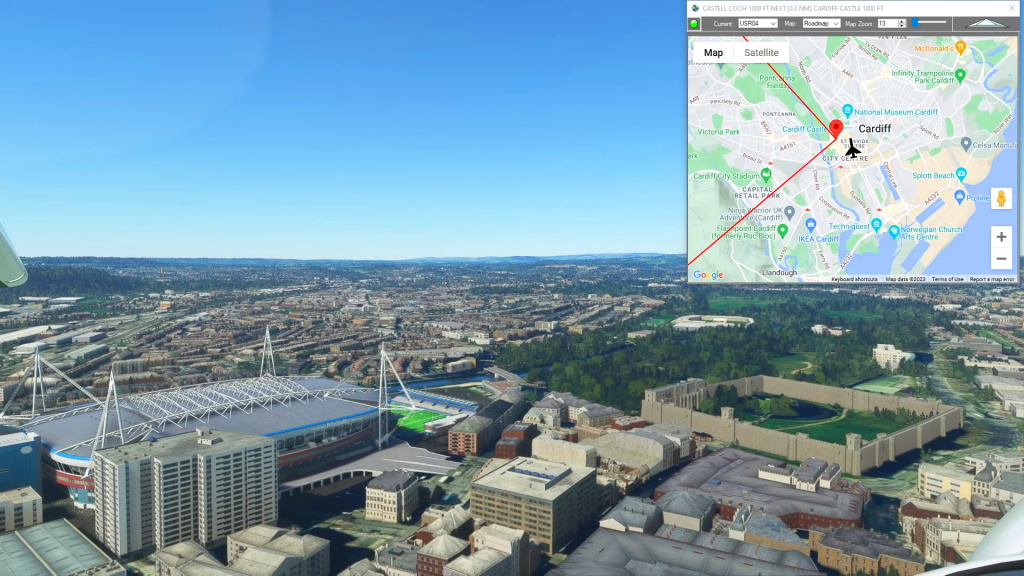
How to use Google Maps in Cockpit
You can use Flightplans Cockpit Map to take Google Maps in the cockpit with you in Microsoft Flight Simulator. You can open any MSFS flight plan and follow your progress on the flight path or just use the Google Map to create a route on-the-fly. Check out the video below for an overview of Cockpit…
How To Create an MSFS Landing Practice
Using Flightplan, you can easily create a planned approach for any airport (or glacier, lake, etc.). Using the Lap Timer, Cockpit Map will record your progress along the flight path, but only if you are under the assigned altitude. The video shows examples at Sedona and Castillion. The key to creating an accurate landing practice…
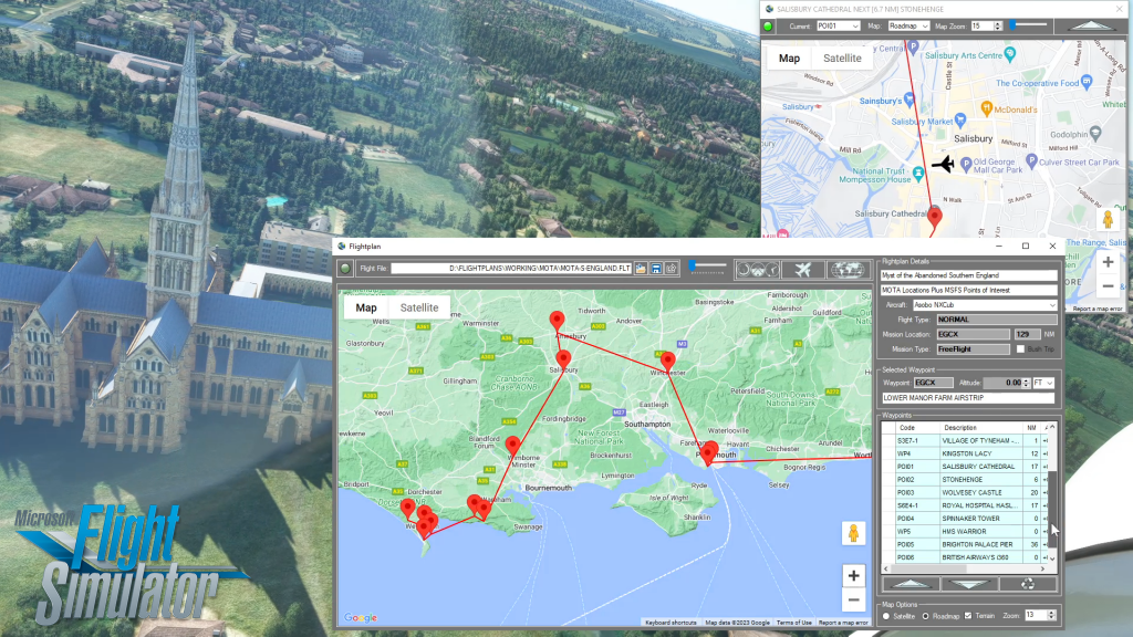
How To Create A Flight Plan in MSFS
There are several ways to copy and save flight plans to create a new flight plan (Check out the videos on our YouTube channel link below). There is not currently a specific New button in Flightplan to create a file from scratch. The primary reason for this is that the values that define the aircraft,…
How do I use Google Maps in MSFS?
With Flightplan for Flight Simulator, you can take Google Maps in the cockpit with you. Flightplans Cockpit Map allows you to see the real-time google map beneath you as you fly. Just like on your phone, Google Maps will display road names, place names, landmarks, street views and 3D photogrammetry as you fly. You can…
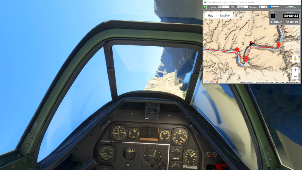
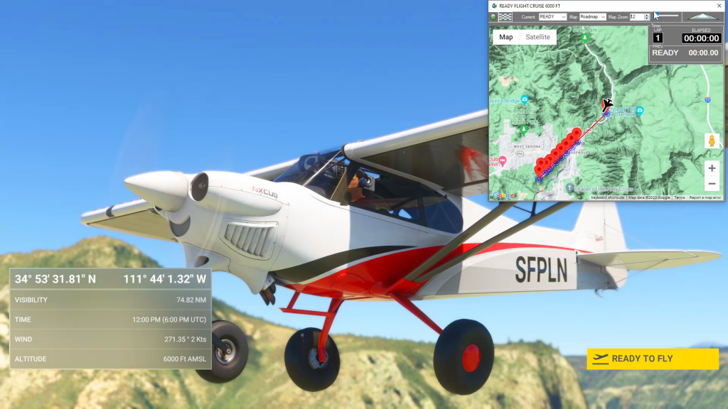
How do I use the Cockpit Map Lap Timer
Cockpit Map has a built in Lap Timer you can use to record lap times if you want to race with your friends, or simply as a hands-free stop watch to use in Bush Trips or free flights. The Lap Timer records your progress as you pass within a given distance from each waypoint. The…
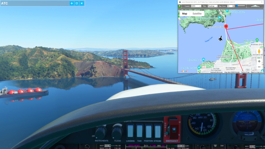
Cockpit Map Features
Cockpit Map can be used in place of Microsoft Flight Simulator’s Nav Map. Cockpit Map displays the loaded flight plan along with the current position of your aircraft over the Google map. When launched, Cockpit map will appear at the top right 1/3 of the primary display. It can be moved or resized to whatever…
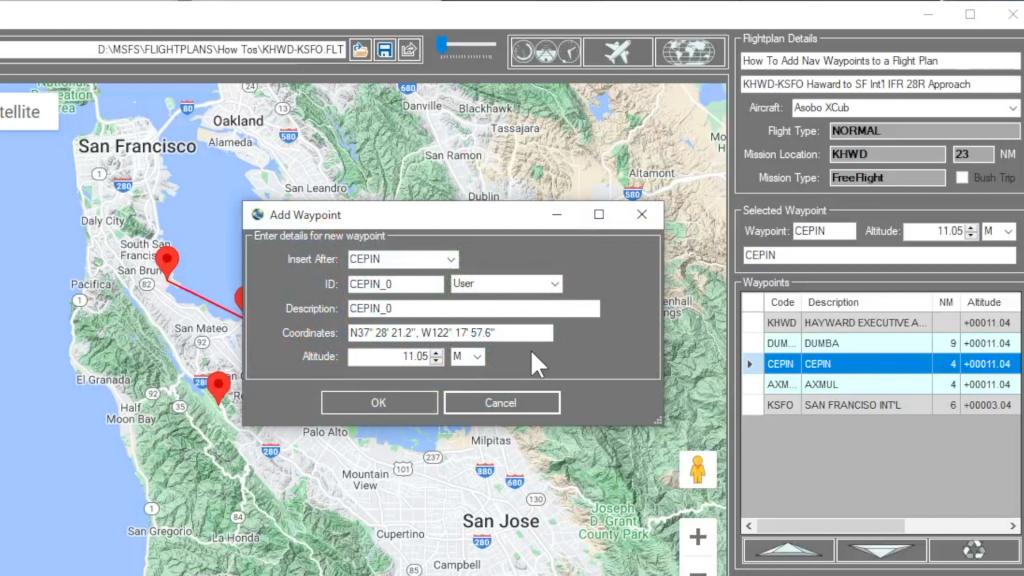
How do I add a new waypoint?
You can add a waypoint to a flight plan by clicking anywhere on the map. Flightplan will drop a push-pin at the coordinate you clicked, and open the Add Waypoint form (see below). You can update the waypoint ID which will show in the glass cockpit if your aircraft is so equipped. You can also…
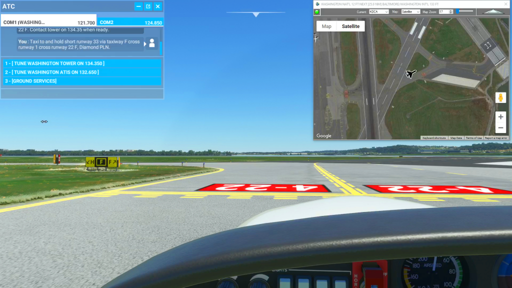
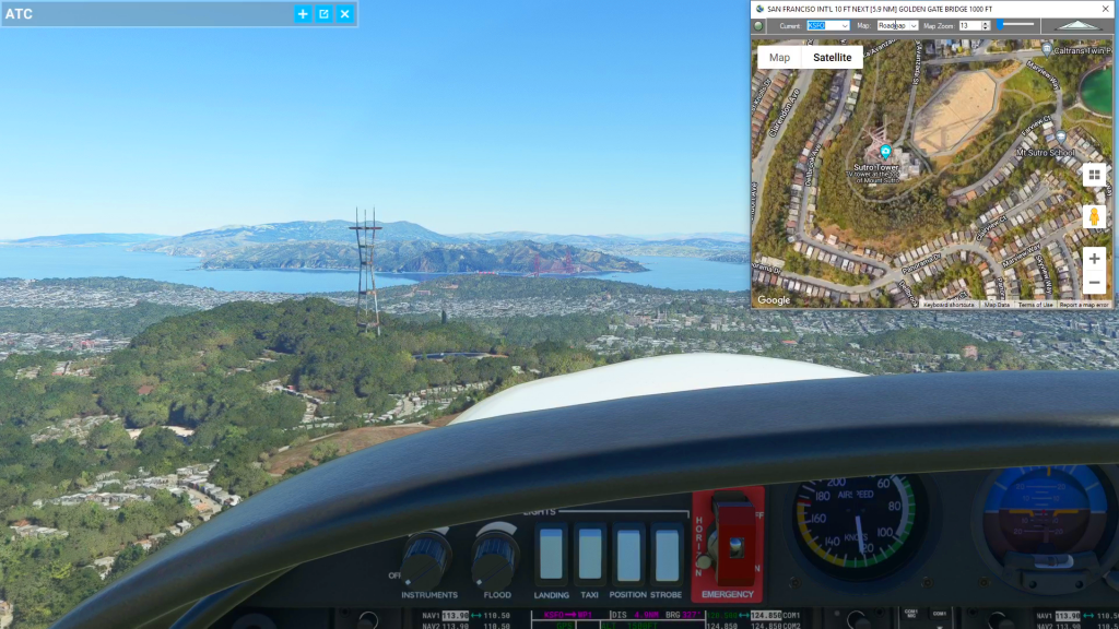
How To Use Satellite View During Taxi
You can use the Satellite view of Cockpit Map to assist with navigating complicated taxiways. Simply turn on GPS Follow mode, set your Zoom level so that you can read the taxiway and runway markings (if the airport is clearly marked) and select Satellite as your Map. You can then follow the ATC taxi route…