
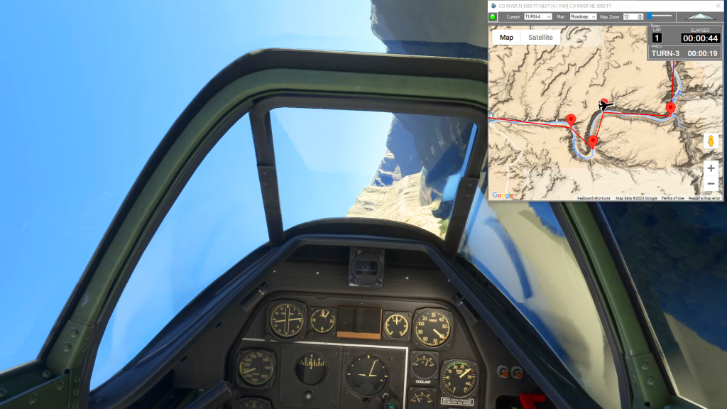
Using Flightplan, you can easily create a planned approach for any airport (or glacier, lake, etc.). Using the Lap Timer, Cockpit Map will record your progress along the flight path, but only if you are under the assigned altitude. The video shows examples at Sedona and Castillion. The key to creating an accurate landing practice…
Nav Map
Flightplan is a flight planning add-on for use with Microsoft Flight Simulator 2020. Flightplan can be used to create and share your own flight plans using an interactive drag-and-drop interface complete with terrain elevations, landmarks, street views, etc.
How do I use Google Maps in MSFS?
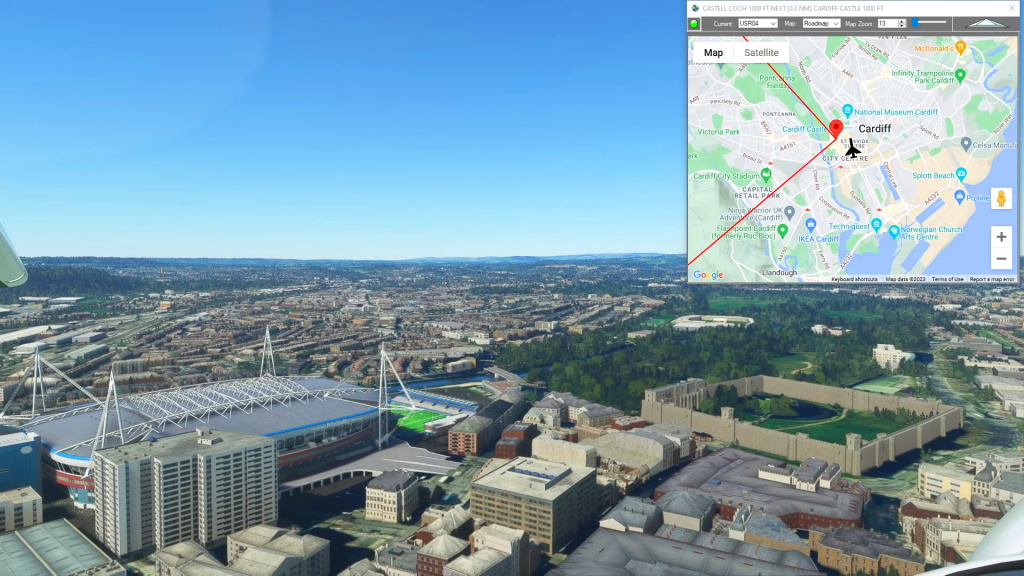
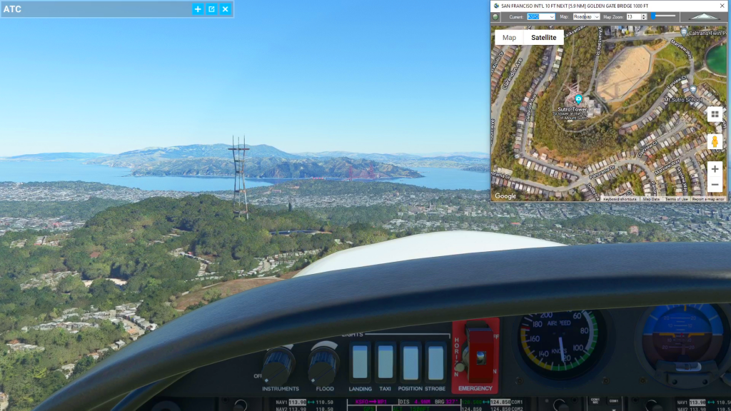
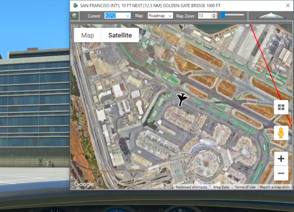
With Flightplan for Flight Simulator, you can take Google Maps in the cockpit with you. Flightplans Cockpit Map allows you to see the real-time google map beneath you as you fly. Just like on your phone, Google Maps will display road names, place names, landmarks, street views and 3D photogrammetry as you fly. You can…
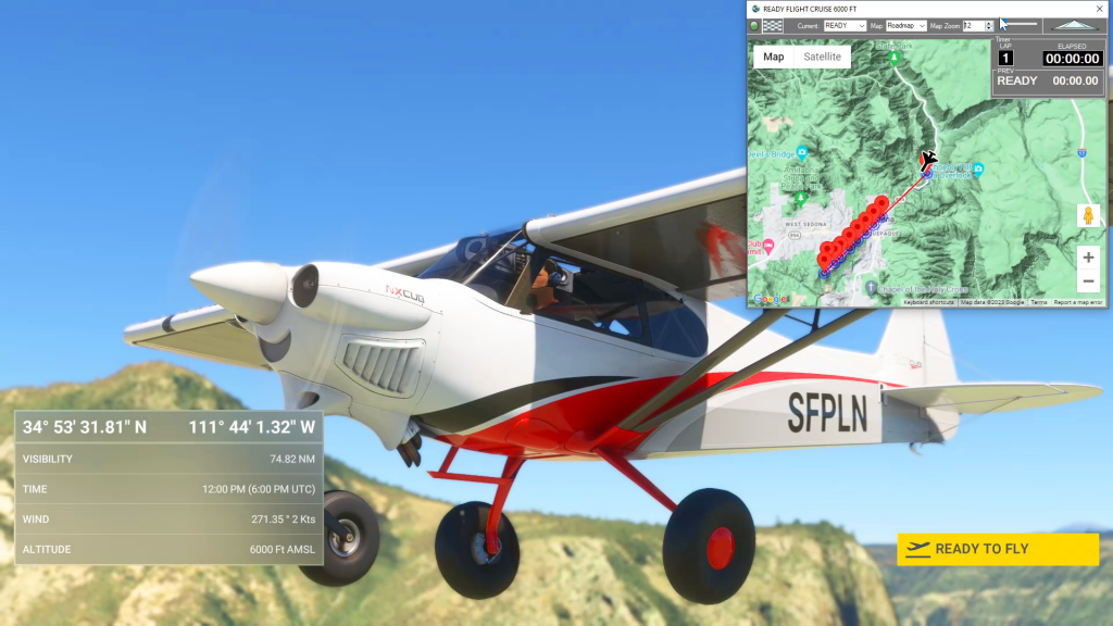
How do I use the Cockpit Map Lap Timer
Cockpit Map has a built in Lap Timer you can use to record lap times if you want to race with your friends, or simply as a hands-free stop watch to use in Bush Trips or free flights. The Lap Timer records your progress as you pass within a given distance from each waypoint. The…
Planned Features List
List of planned features and functions to be added to Flightplan in the next release. Please feel free to comment with any we’ve missed.
How can I quickly convert elevations from meters to feet in MSFS 2020?
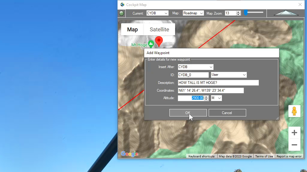
You can drop a pin anywhere and enter the desired altitude using either Meters (M) or Feet (FT) and when the Pin is added to the map it will be converted to your flight plan unit of measure. So if you are used to flying using Imperial units of measure (feet) but the local elevations…
Feature Release
List of features added in conjunction with the Microsoft 40th Anniversary Edition of Microsoft Flight Simulator
Cockpit Map
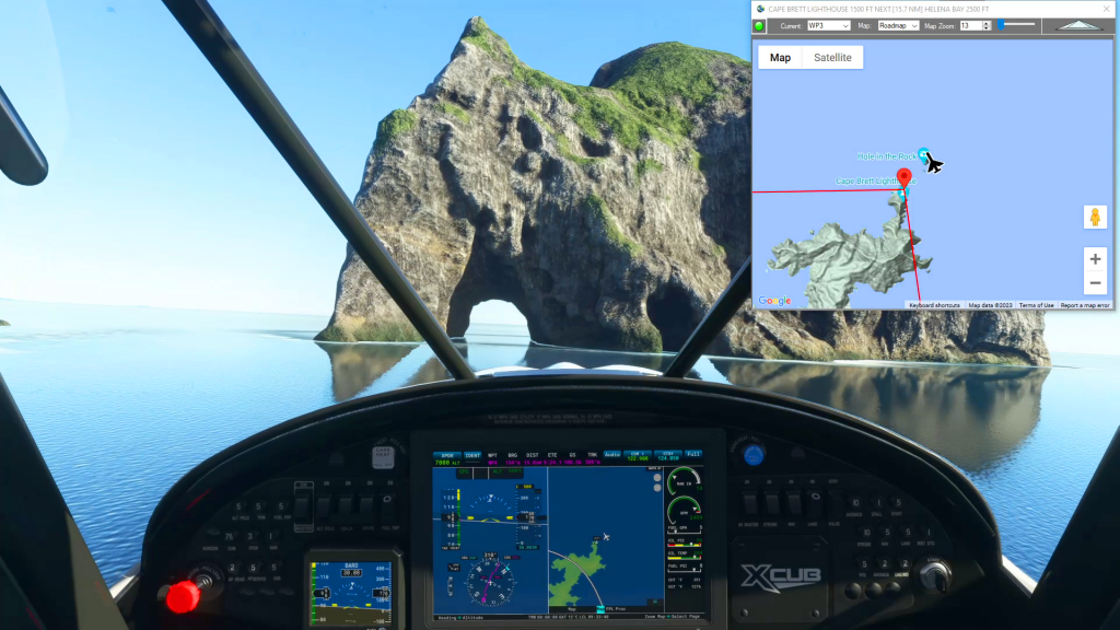
When in-flight during gameplay, the Cockpit Map can replace Nav Map to maintain a virtual GPS fix on your position and previous/next waypoints. It displays the path and distance to waypoints in the selected flight plan with real-time aircraft location and flight path. The floating Cockpit Map can be moved and resized and the transparency…

Google Maps Integration
Flightplan is a Google Maps flight planning add-on for use with Microsoft Flight Simulator 2020. Flightplan can be used to create and share your own flight plans using an interactive Google Maps drag-and-drop interface complete with terrain elevations, landmarks, streetviews, etc. Click on the interactive map to drop a pin at any location on earth,…