
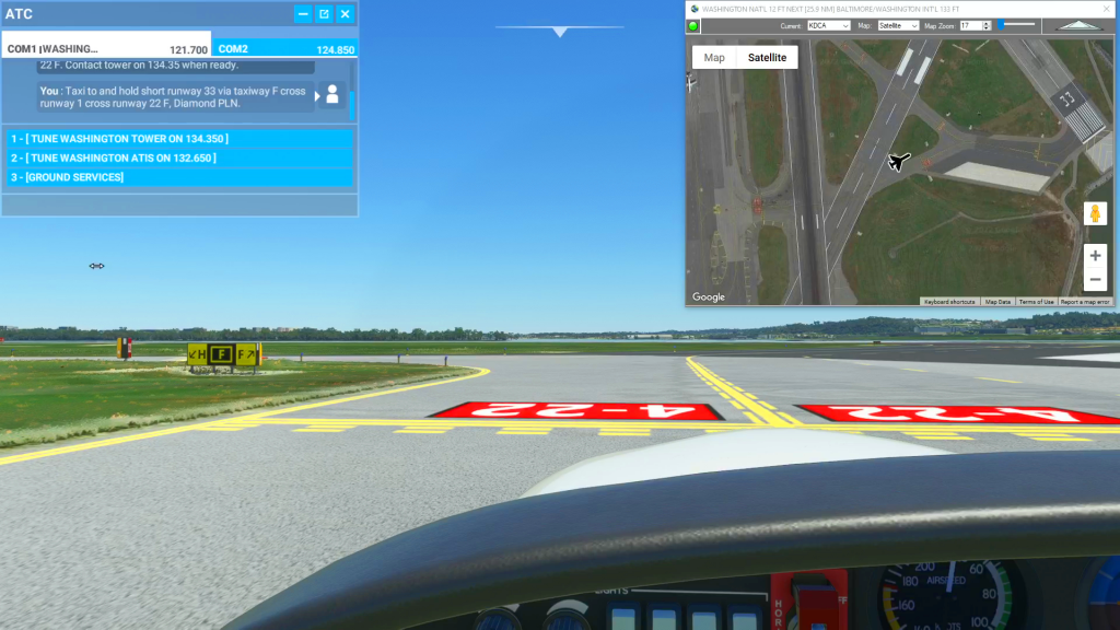
You can use the Satellite view of Cockpit Map to assist with navigating complicated taxiways. Simply turn on GPS Follow mode, set your Zoom level so that you can read the taxiway and runway markings (if the airport is clearly marked) and select Satellite as your Map. You can then follow the ATC taxi route…
MSFS 2020 Flight Planner
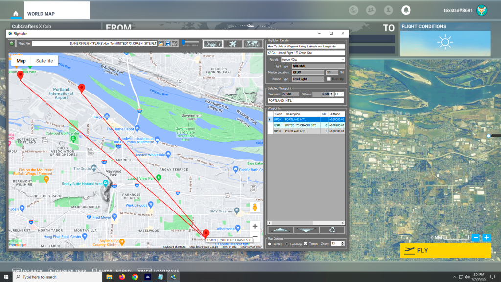
Flightplan is a Google Maps flight planning add-on for use with Microsoft Flight Simulator 2020. You can use Cockpit Map to take Google Maps in the cockpit with you to use real time terrain elevations, road maps, landmarks, satellite views and street view 3D imagery. Flightplan can also be used to create and share your own flight plans using an interactive drag-and-drop, Google Maps interface.
Download Flightplan and try it yourself – the link is at the bottom of the page.
You can also download and fly any of our free flight plans using the Download Link at the top. Load them in MSFS World Map and you are ready to fly.
For more information see the topics below or check out our YouTube channel or FAQ page.
Happy Flying!

How can I create a new flight plan?
There are several ways to copy and save flight plans to create a new flight plan (Check out the videos on our YouTube channel link below). However there is not currently a specific New button in Flightplan to create a file from scratch. The primary reason for this is that the values that define the…
How can I add a point if I know the coordinates?
You can add a new waypoint to your flight plan using latitude and longitude, but you must format the coordinate as follows: Which is as follows: The cardinal compass direction and degrees of latitude including the ° symbol (use Alt + 0176 on a Windows keyboard) then a space. Next are minutes with no decimal…