
Flightplan does not display Nav Waypoints on the map unless they are waypoints on the flight plan. The assumption is that the glass cockpit will take care of that for you, so displaying the Nav Waypoints in Cockpit Map is really not necessary (although they may be added in future versions of Flightplan). However you…
Flight Simulator Google Maps
Flightplan is a Google Maps flight planning add-on for use with Microsoft Flight Simulator 2020. You can use Cockpit Map to take Google Maps in the cockpit with you to use real time terrain elevations, road maps, landmarks, satellite views and street view 3D imagery. Flightplan can also be used to create and share your own flight plans using an interactive drag-and-drop, Google Maps interface.
Download Flightplan and try it yourself – the link is at the bottom of the page. You can also download and fly any of our free flight plans using the Download Link at the top. Load them in MSFS World Map and you are ready to fly.
For more information see the topics below or check out our YouTube channel or FAQ page.
Happy Flying!
What do the Google maps push pin icons mean?
It is surprisingly difficult to find a complete legend of all the map icons you might see on Google maps. Below is what was in a Google blog post from 2017 which corresponded with a feature release. This list is most probably not complete, but it was difficult enough to find that we decided to…
How To Create A Bush Trip
You can use Flightplan to create multi-leg flights that mimick the in game Bush Trips in Microsoft Flight Simulator. Flightplan creates Free Flight type flight plans that can be flown in sequence by simply loading the next consecutive flight plan after landing. The http://simflightplan.com/staging/series/pacific-nw/ Pacific Northwest Series is an example of this. See the YouTube…

How To Create A Landing Practice
You can practice challenging approaches from the MSFS 2020 Bush Trips in Flight Plan. Just copy the Bush Trip to a Free Flight, then delete the waypoints you don’t want. You can use the contour lines on the map to determine your runway elevation if you aren’t certain of it. You can also review the…
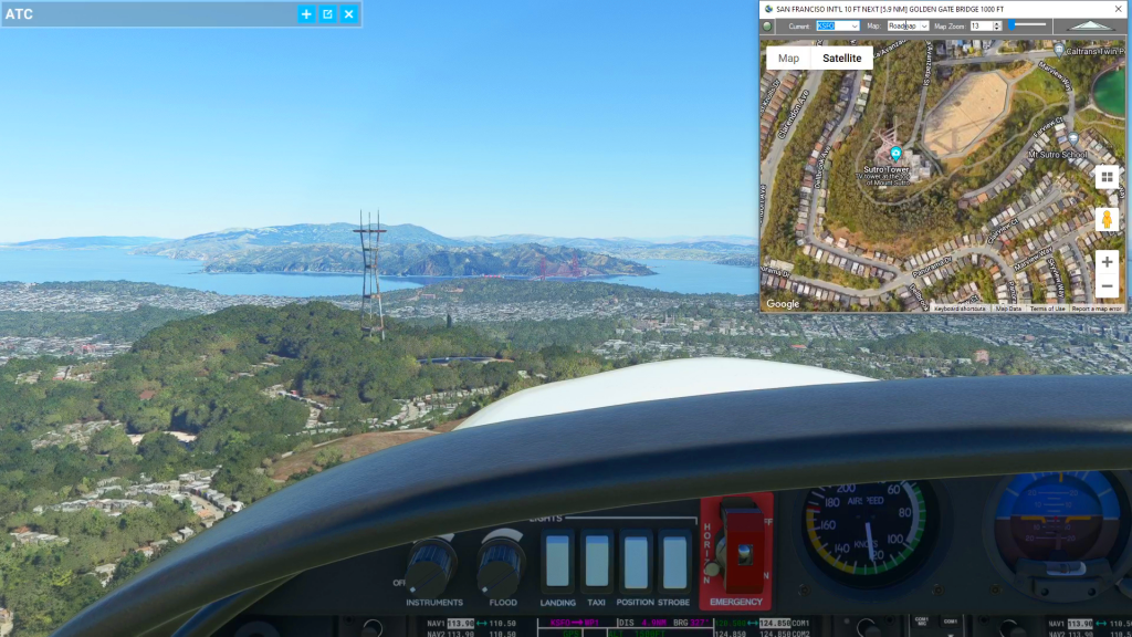
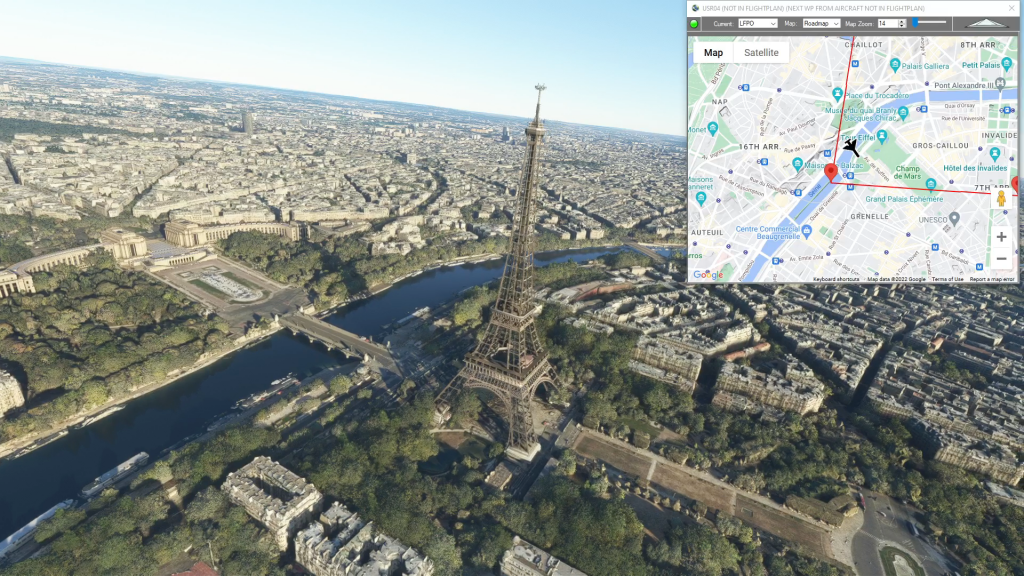
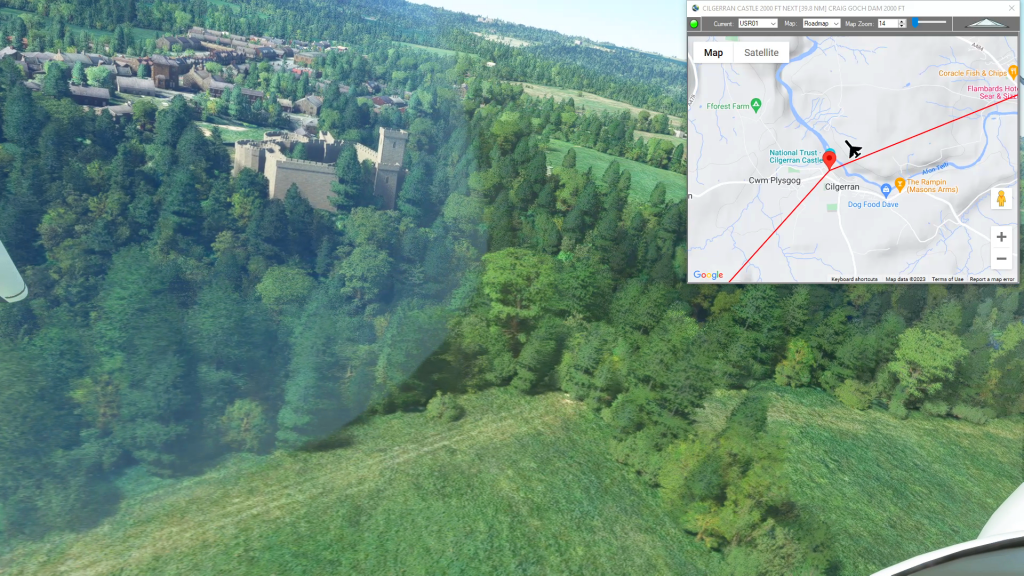
Cockpit Map Features
Cockpit Map can be used in place of Microsoft Flight Simulator’s Nav Map. Cockpit Map displays the loaded flight plan along with the current position of your aircraft over the Google map. When launched, Cockpit map will appear at the top right 1/3 of the primary display. It can be moved or resized to whatever…
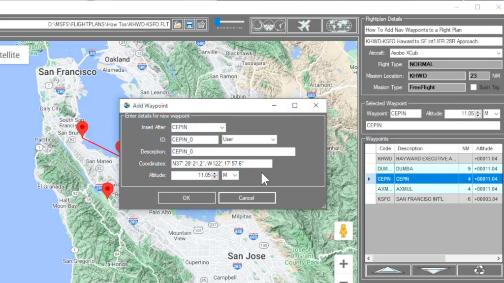
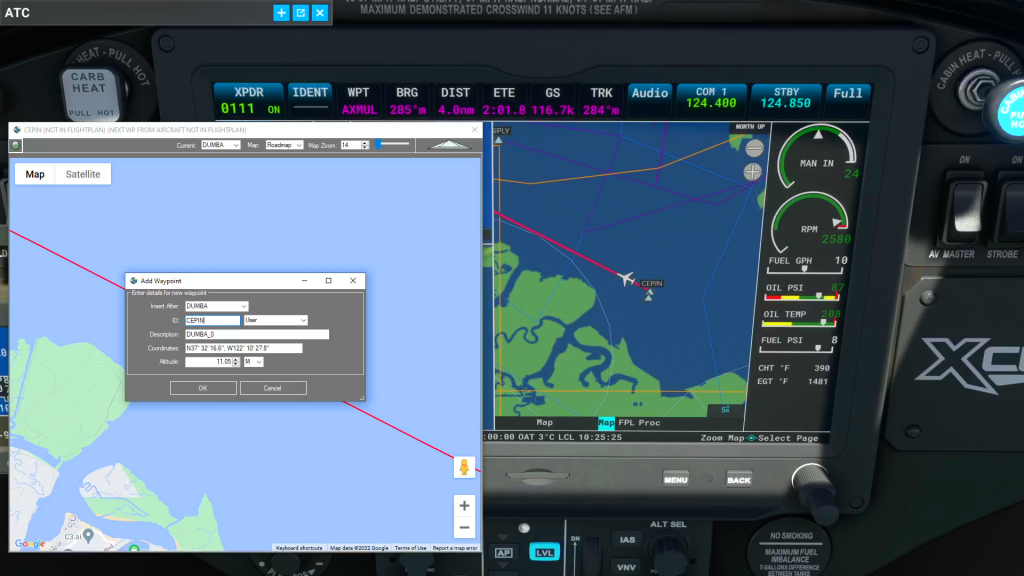
How do I add a new waypoint?
You can add a waypoint to a flight plan by clicking anywhere on the map. Flightplan will drop a push-pin at the coordinate you clicked, and open the Add Waypoint form (see below). You can update the waypoint ID which will show in the glass cockpit if your aircraft is so equipped. You can also…
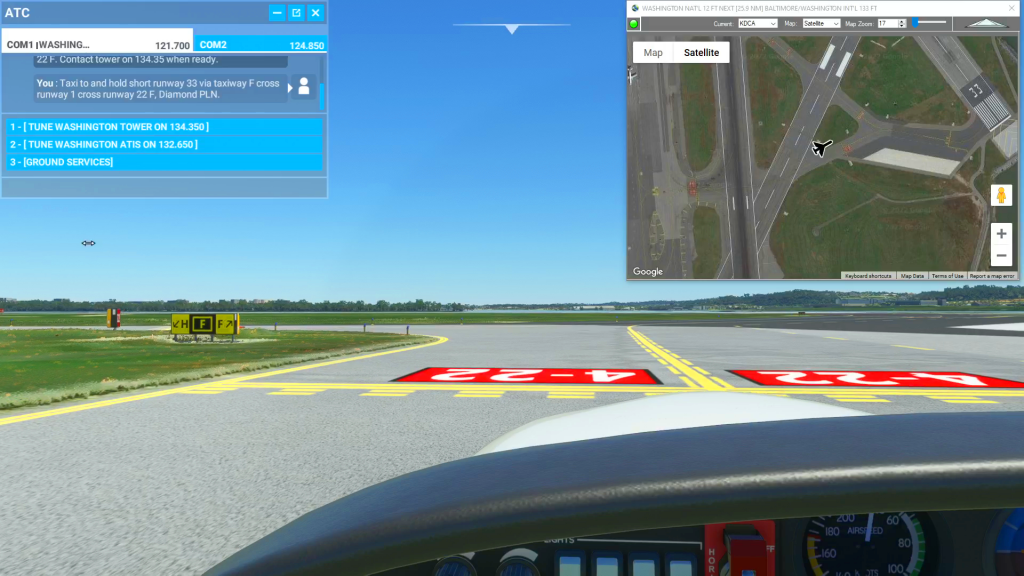
How To Use Satellite View During Taxi
You can use the Satellite view of Cockpit Map to assist with navigating complicated taxiways. Simply turn on GPS Follow mode, set your Zoom level so that you can read the taxiway and runway markings (if the airport is clearly marked) and select Satellite as your Map. You can then follow the ATC taxi route…