
Flightplan does not display Nav Waypoints on the map unless they are waypoints on the flight plan. The assumption is that the glass cockpit will take care of that for you, so displaying the Nav Waypoints in Cockpit Map is really not necessary (although they may be added in future versions of Flightplan). However you…
Cockpit Map Features
Flightplan is a Google Maps flight planning add-on for use with Microsoft Flight Simulator 2020. You can use Cockpit Map to take Google Maps in the cockpit with you to use real time terrain elevations, road maps, landmarks, satellite views and street view 3D imagery. Flightplan can also be used to create and share your own flight plans using an interactive drag-and-drop, Google Maps interface.
Download Flightplan and try it yourself – the link is at the bottom of the page. You can also download and fly any of our free flight plans using the Download Link at the top. Load them in MSFS World Map and you are ready to fly.
For more information see the topics below or check out our YouTube channel or FAQ page.
Happy Flying
How do I use the Cockpit Map Lap Timer
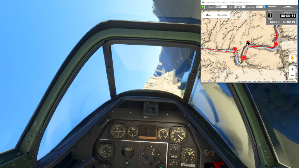
Cockpit Map has a built in Lap Timer you can use to record lap times if you want to race with your friends, or simply as a hands-free stop watch to use in Bush Trips or free flights. The Lap Timer records your progress as you pass within a given distance from each waypoint. The…
Cockpit Map Features
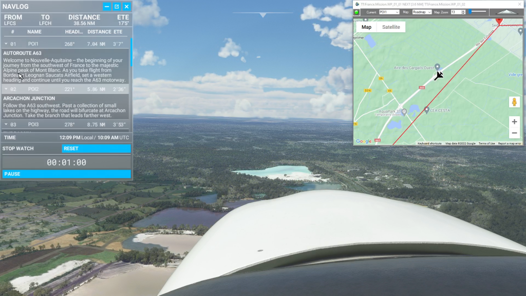
Cockpit Map can be used in place of Microsoft Flight Simulator’s Nav Map. Cockpit Map displays the loaded flight plan along with the current position of your aircraft over the Google map. When launched, Cockpit map will appear at the top right 1/3 of the primary display. It can be moved or resized to whatever…
How can I quickly convert elevations from meters to feet in MSFS 2020?
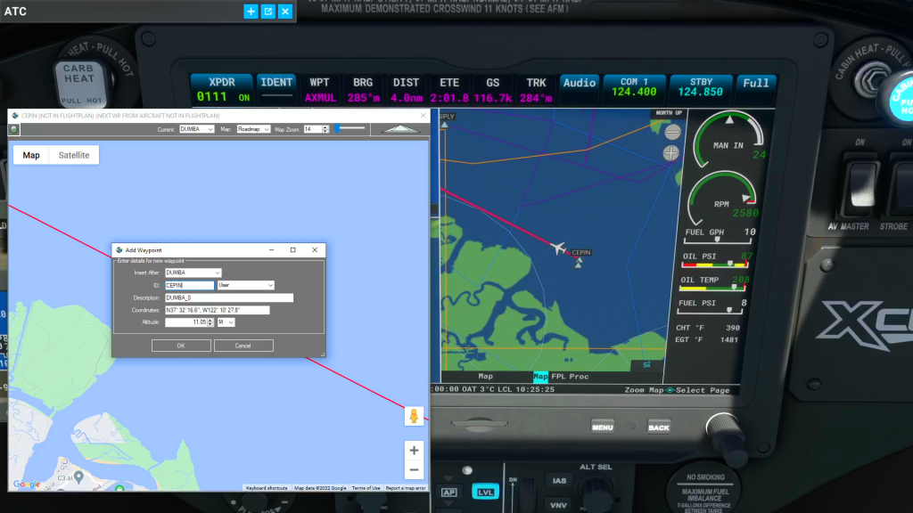
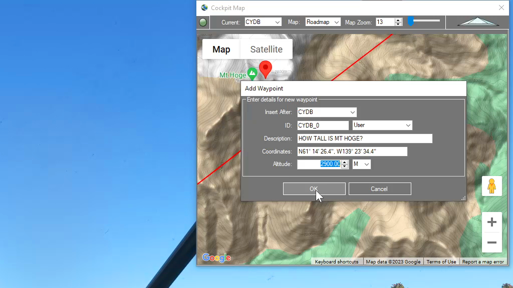
You can drop a pin anywhere and enter the desired altitude using either Meters (M) or Feet (FT) and when the Pin is added to the map it will be converted to your flight plan unit of measure. So if you are used to flying using Imperial units of measure (feet) but the local elevations…
How To Use Satellite View During Taxi
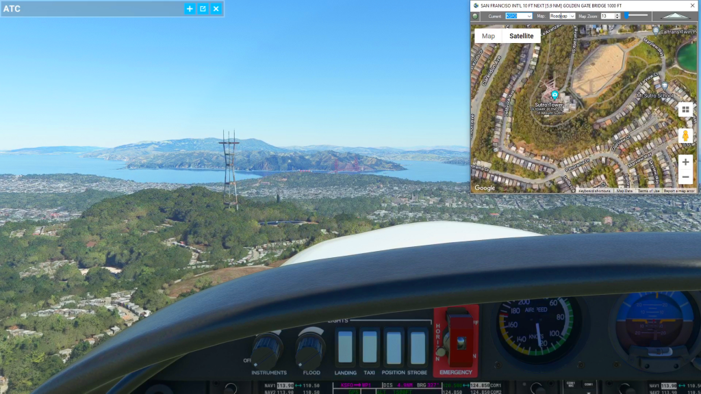
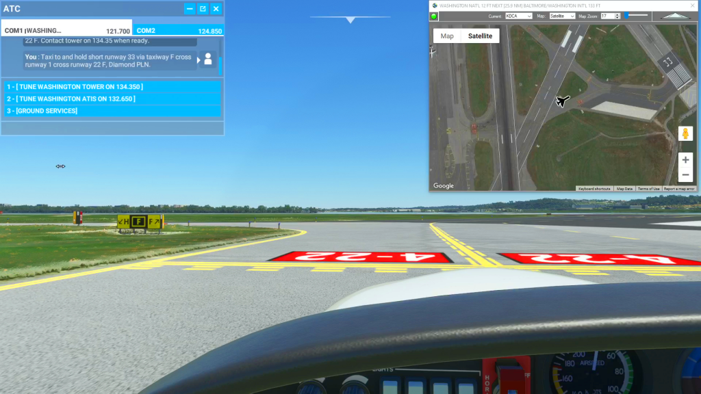
You can use the Satellite view of Cockpit Map to assist with navigating complicated taxiways. Simply turn on GPS Follow mode, set your Zoom level so that you can read the taxiway and runway markings (if the airport is clearly marked) and select Satellite as your Map. You can then follow the ATC taxi route…
Isn’t it cheating to use Cockpit Map in a Bush Trip?
Well yes, from a navigation perspective the point of Bush Trips is to use the Nav Log and VFR to navigate the route. Although some of the Nav Log descriptions are vague and hard to follow on a number of built-in Bush Trips so it can be difficult to find the landmarks mentioned (even if…