
Download and fly as many flight plans as you like! Just download and unzip the flight plan files and open them in Microsoft Flight Simulator – World Map, or use Flightplan to change your aircraft, modify waypoints or create your own flight plans and share them here. Check out the Frequently Asked Questions page or our YouTube Channel for more information.
Happy Flying!
You can search for specific flight plans by city/place names or ICAO code or even by author name to find your own or your friends flight plans. You can also search by series like Pacific Northwest, Lord of the Rings and Navajo Volcanic Field, etc. And if you want to create your own series, just make sure to include the exact same phrase somewhere in your flight plan additional text when you share it (ex. “this is leg xxx of the Pacific Northwest series…”)
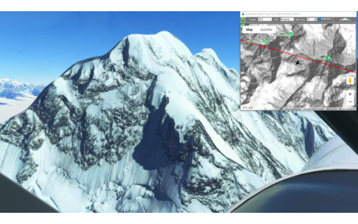
This is the 23rd leg of the Pacific Northwest Series, flying the XCub with skis so that we can land on a glacier at the foot of Mt Logan in British Columbia. This leg takes off from Icy Bay on the Pacific Coast and skirts the US-Canada border before turning north for a glacier landing.
This is the flight plan used in the YouTube video https://youtu.be/NaiSEgcXpr8
19AK-GLA1 Icy Bay to Mt Logan BC
Asobo XCub Skis
19AK: ICY BAY AIRPORT
WP1: [14.35 NM] TAAN FJORD
WP2: [13.16 NM] HAYDON PEAK
WP3: [10.70 NM] MT BERING
WP4: [8.88 NM] MT EATON
GLA1: [9.76 NM] MT LOGAN GLACIER LANDING
Total Distance: 56.86 NM
Flightplan by texstan

This flight plan starts in Kathmandu and has waypoints for several temples and stupas in Kathmandu before starting the long climb into the Himalayas. Climb to 20,000 to clear the China-Nepal border and continue climbing to the highest point on Earth at nearly 30,000 feet. After checking out the base camps along the Nepalese route to the summit, descend rapidly to land at Tenzing-Hillary Airport at 9,250 feet.
This is the flight plan used in the YouTube video https://youtu.be/P9Ywru1xCno
VNKT-VNLK Tribihuvan to Tenzing-Hillary
Pilatus PC-6 Gauge Skis
VNKT: TRIBHUVAN AIRPORT
USR01: [0.84 NM] PASHUPATINATH TEMPLE
USR02: [2.23 NM] DURBAR SQUARE
USR03: [0.21 NM] SETO MACHHINDRA NATH TEMPLE
USR04: [1.15 NM] SWOYAMBHU MAHACHAITYA
USR05: [3.78 NM] BUDDHA STUPA
USR06: [3.52 NM] CHANGUNARAYAN TEMPLE
USR07: [5.70 NM] JAMCHEN STUPA
USR08: [71.43 NM] CHO OYU MOUNTAIN
USR09: [15.33 NM] MT EVEREST
VNLK: [20.83 NM] TENZING-HILLARY AIRPORT
Total Distance: 125.07 NM
Flightplan by texstan

This is the 22nd leg of the Pacific Northwest Series. Take off from Yakutat Airport and fly over Hubbard Glacier before climbing to 13,500 to the peak of Mt. Cook (Alaska). Then drift down over the glaciers and inlets to land at Icy Bay.
This is the flight plan used in the YouTube video https://youtu.be/Mm-FOclbQH8
PAYA-19AK Yakutat to Icy Bay
Asobo XCub
PAYA: YAKUTAT AIRPORT
WP1: [34.15 NM] HUBBARD GLACIER
WP3: [19.03 NM] MT COOK
WP4: [22.43 NM] OILY LAKE
19AK: [29.86 NM] ICY BAY AIRPORT
Total Distance: 105.49 NM
Flightplan by texstan
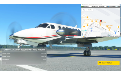
This flight plan is an example of how you can save any aircraft with specific avionics and flight control settings, then use Flightplan to reuse that aircraft configuration as many times as you want. The example uses the Beechcraft King Air, fully started with lights and avionics turned on, but at a parking spot ready to taxi. As an example the Wind Vector display setting is saved in the PFD as well. This choice of airports was arbitrary.
This is the flight plan from the YouTube video with the same title https://youtu.be/pEBAFmg2XU8
See the FAQ Article for more information.
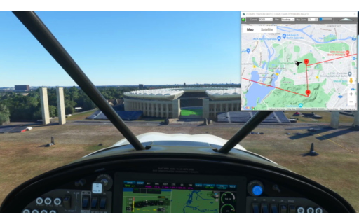
KPDX-KSFO King Air Ready-to-Taxi
Beechcraft King Air 350i Asobo
KPDX: PORTLAND INT’L
KSFO: [478.35 NM] SAN FRANCISCO INT’L
Total Distance: 478.35 NM
Flightplan by texstan

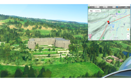
This is the final leg of the Welsh Castles homegrown Bush Trip, from Shobdon to Gloucestershire. Along the way fly over Skinfirth and Goodrich Castles and explore the many others off the direct flight path.
This is the flight plan used in the YouTube video https://youtu.be/vXGGgaVxInM
EGBS-EGBJ Shobdon to Gloucestershire
Asobo NXCub
EGBS: SHOBDON AERODROME
USR01: [7.78 NM] HAMPTON COURT CASTLE
USR02: [17.68 NM] SKENFRITH CASTLE
USR03: [6.45 NM] GOODRICH CASTLE
EGBJ: [16.65 NM] GLOUCESTERSHIRE AIRPORT
Total Distance: 48.57 NM
Flightplan by texstan
This is the penultimate leg of the Wales Bush Trip and includes Rowton and Powis Castles, along with several others both on and off the flight plan. Take off from Whittington Airport (AKA Rednal) and wind south along the Welsh-English border to Shobdon Aerodrome.
This is the flight plan used in the YouTube video https://youtu.be/Gm-BVwNg1fo
EGAZ-EGBS Whittington to Shobdon
Asobo NXCub
EGAZ: WHITTINGTON AIRPORT
USR01: [8.46 NM] ADMIRAL RODNEYS PILLAR
USR02: [4.58 NM] ROWTON CASTLE
USR03: [9.43 NM] POWIS CASTLE AND GARDEN
USR04: [7.07 NM] DOLFORWYN CASTLE
USR05: [22.55 NM] CROFT CASTLE
EGBS: [3.70 NM] SHOBDON AERODROME
Total Distance: 55.83 NM
Flightplan by texstan
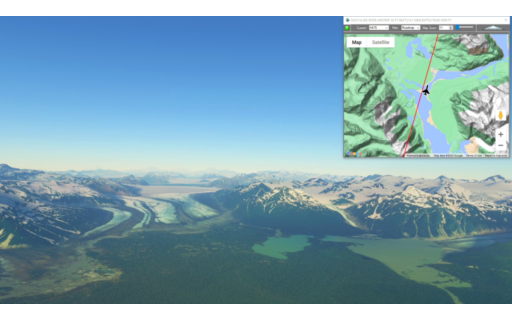
This is the 20th leg of the Pacific Northwest Series. It picks up at Alsek River and winds along the mountains and glaciers of the US – Canada border. To avoid probles with newer Garmin Cockpits you may want to change the aircraft to a non-Garmin glass cockpit (such as the X-Cub) or download the DA40-NGX mod that I used in the video here https://flightsim.to/file/2738/da40-ngx-project
This is the flight plan used in the video https://youtu.be/8XWEdZXrmJA
AK76-CYHT East Alsek River to Haines Junction Airstrip
DA40-NG Asobo
AK76: EAST ALSEK RIVER AIRSTRIP
WP1: [28.11 NM] BATTLE PEAK
WP2: [15.15 NM] MT VIKITSKY
WP3: [14.94 NM] MT BLACKADAR
WP4: [30.28 NM] LOWELL PEAK
WP5: [13.21 NM] INUPIAT PEAK / LOWY PEAK
CYHT: [38.58 NM] HAINES JUNCTION AIRSTRIP
Total Distance: 140.31 NM
Flightplan by texstan
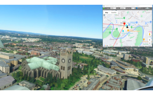
This flight plan contains a collection of waypoints in and around Berlin, Germany taken from the Mysteries of the Abandoned TV show on Science Channel. There are also waypoints for the MSFS World Map points of for convenience.
This is the flight plan used in the YouTube video https://youtu.be/QsRv1KRtK5w
ED15-EDAZ MOTA Locaitons and MSFS Points of Interest
Asobo NXCub
ED15: KREMMEN-HOHENBRUCH
S5E2-1: [6.73 NM] NAZI SS BAKERY / SACHSENHAUSEN
S4E9-1: [17.07 NM] 1936 OLYMPIC VILLAGE
S2E5-1: [8.81 NM] TEUFELSBERG HILL RADOMES
POI05: [1.03 NM] OLYMPIC STADIUM
POI01: [2.09 NM] CHARLOTTENBURG PALACE
POI02: [2.05 NM] TIERGARTEN
POI03: [0.85 NM] REICHSTAG
POI04: [0.25 NM] BRANDENBURG GATE
POI06: [0.81 NM] BERLIN CATHEDRAL / MUSEUM ISLAND
POI07: [0.28 NM] ST NICHOLAS CHURCH
POI08: [0.29 NM] BERLIN TELEVISION TOWER
S4E8-1: [2.87 NM] STASSI PRISON / HQ COMPLEX
S5E6-2: [14.04 NM] RANGSDORF AIRFIELD
S4E3-2: [5.50 NM] ZEPPELIN BUNKER – NAZI & SOVIET ERA
S3E8-2: [1.93 NM] RED ARMY HQ – SOVIET ERA
S3E1-2: [21.20 NM] BEELITZ SANITORIUM – TB HOSTPITAL c1898
EDAZ: [8.99 NM] SCHONHAGEN AIRPORT
Total Distance: 94.86 NM
Flightplan by texstan
This is the seventh leg of the Wales Bush Trip and includes Flint Castle, Chester Cathedral and several other points of interest.
This is the flight plan used in the YouTube video https://youtu.be/wPHxkv25hig
EGCE-EGAZ Bryngwyn to Whittington
Asobo NXCub
EGCE: BRYNGWYN BACH AIRFIELD
USR20: [8.38 NM] FLINT CASTLE
USR21: [3.84 NM] EWLOE CASTLE
USR22: [6.33 NM] CHESTER CATHEDRAL / EASTGATE CLOCK
USR23: [15.10 NM] PONTCYSYLITE AQUEDUCT
USR24: [2.68 NM] CHIRK AQUEDUCT
EGAZ: [6.83 NM] WHITTINGTON AIRPORT
Total Distance: 43.19 NM
Flightplan by texstan
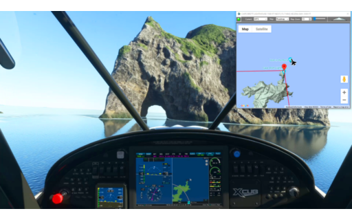
This is actually the same flight plan as the first leg of our Lord of the Rings series. But this one will spawn you in flight just west of the Hole in the Rock in North NZ in the X-Cub. You can indeed fly through the Hole In the Rock with an X-Cub.
This is the flight plan used in the YouTube video https://youtu.be/l6o6PtyIYwg
NZKT-NZWR Kaitaia Airport to Whangarei
Asobo XCub
NZKT: KAITAIA AIRPORT
WP1: [22.61 NM] WHANGAROA HARBOUR
WP2: [16.61 NM] TE PUNA INLET
WP3: [14.55 NM] CAPE BRETT LIGHTHOUSE
WP4: [15.53 NM] HELENA BAY
NZWR: [20.38 NM] WHANGAREI AIRPORT
Total Distance: 89.69 NM
Flightplan by texstan