
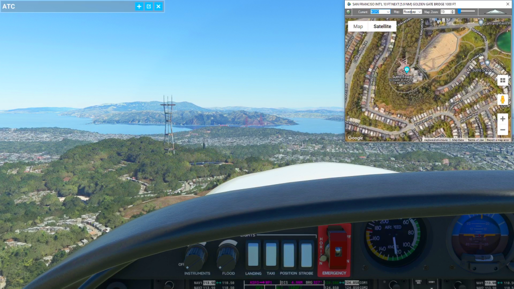
Cockpit Map can be used in place of Microsoft Flight Simulator’s Nav Map. Cockpit Map displays the loaded flight plan along with the current position of your aircraft over the Google map. When launched, Cockpit map will appear at the top right 1/3 of the primary display. It can be moved or resized to whatever you preference is.
In the upper left corner is the GPS Follow button. The green light will be "lit" if Cockpit Map is currently following the progress of the aircraft using the current coordinates from Microsoft Flight Simulator. If you drag the map to pan, or change the zoom level on the map, GPS Follow will automatically be turned off and the Aircraft Icon will remain at the last known postion. Once GPS Follow mode is turned back on the Aircraft Icon will be moved to the latest position from MSFS and will update it's position as it changes.
The Current drop-down list maintains the most recent waypoint you passed in the flight plan. Microsoft Flight simulator will update your "Last" and "Next" waypoints each time it passes a waypoint (typically at 0.5 NM). Cockpit Map will hold your "Last" waypoint as the Current Waypoint until Flight Simulator changes the value again. The Current waypoint is used to display the waypoint description and requested altitude in the caption of the Cockpit Map. It also, uses the drop-down value to determine what the "Next" waypoint is in the flight plan (typically the same as the next waypoint from MSFS). You can also manually select a Current waypoint that is different than what Flight Simulator is using. Cockpit Map will then use this manually selected waypoint to determine what your "next" waypoint should be. It will use this information to display the waypoint and distance information in the caption, and it will change the "Current" label to Green to indicate manual tracking. You can double-click the "Current" label to change it back to White and resume following the waypoints transmitted by MSFS.
The Map drop-down indicates your preferred map type when GPS Follow is engaged. The choices are Roadmap or Satellite, and there are buttons for the same option on the map itself. You can use the buttons on the map to momentarily swich your map view to Satellite (for example) to search for a particular landmark. Then when you click GPS Follow to turn it back on, the map will return to Roadmap (for example) if that's what the Map drop-down is set to. This value can also be set at the bottom of the main Flightplan form.
Map Zoom works exactly like the Map drop-down. There are zoom (+/-) on the map that you can use to temporarily zoom in or out on a map or satellite view. Once you turn GPS Follow back on, the map will return to the zoom level set in the Map Zoom field. This value can also be set at the bottom of the main Flightplan form.
The Transparency Slider can be used to increase or decrease the transparency of Cockpit Map, allowing you to simulate a Heads Up Display (HUD). Increasing trasparency will allow you to see what is "behind" the map while decreasing transparency will be make Cockpit Map more opaque. This value can also be set at the top of the main Flightplan form.
Check out the video above to learn how, as well as the other videos in our How To playlist on YouTube at https://youtube.com/@Simflightplan
This is the archive version of Flightplan to include the racing features. Support is available, but there will be no further software updates. Please download the latest version at Flightplan for Flight Simulator if you are not planning to use the racing features.
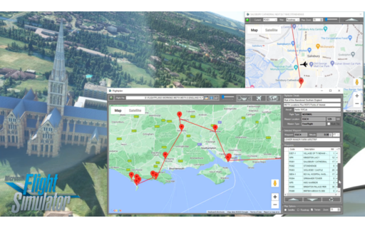
Flightplan is a Google Maps flight planning add-on for use with Microsoft Flight Simulator 2020. Flightplan can be used to create and share your own flight plans using an interactive Google Maps drag-and-drop interface complete with terrain elevations, landmarks, streetviews, etc. Click on the interactive map to drop a pin at any location on earth, plus edit your aircraft and flight plan settings before you get in the cockpit.
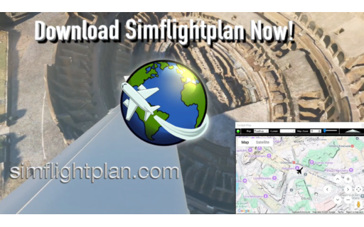
Download Flightplan for Flight Simulator for free now! Google Maps API subscription is included free for 2 weeks.
Flightplan is always free to use for editing and modifying flight plans, a Google Maps API subscription is required to continue using the map features. Software updates and upgrades are free for life.
Note: Each PC can be registered to only 1 user, so please make sure you are using the same PC you run Microsoft Flight Simulator 2020 on when you open Flightplan for the first time.
Flightplan is a Google Maps flight planning add-on for use with Microsoft Flight Simulator. Flightplan can be used to create and share your own flight plans using an interactive Google Maps drag-and-drop interface complete with terrain elevations, landmarks, streetviews, etc. Click on the interactive map to drop a pin at any location on earth, plus edit your aircraft and flight plan settings before you get in the cockpit.
Download Flightplan for Flight Simulator for free now! Google Maps API subscription is included free for 7 days.
Flightplan is always free to use for editing and modifying flight plans, a Google Maps API subscription is required to continue using the map features. Software updates and upgrades are free for life.
Note: Each PC can be registered to only 1 user, so please make sure you are using the same PC you run Microsoft Flight Simulator 2020 on when you open Flightplan for the first time.