
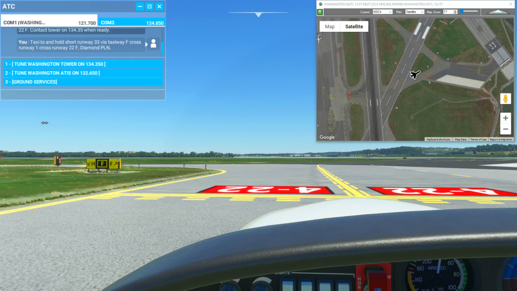
The video demostrates using Cockpit Map to help you taxi from parking to runway 33 at KDCA Washington Nat'l using the real-time satellite view to identify the taxiway markings. Use this flight plan to try it out for yourself in Microsoft Flight Simulator 2020.
Note: In the video the DA40-NGX Improvement Mod has been used which makes the DA40 much easier to fly - you can check it out at https://flightsim.to/file/2738/da40-ngx-project
Thank you to mrtommymxr for the excellent mod.
This is the flight plan used in the YouTube Video:How To Use Satellite View to Assist During Taxi https://youtu.be/-soO3WTJ8oo
KDCA to KBWI Washington Nat'l to Baltimore/Wash Int'l
DA40-NG Asobo
KDCA: WASHINGTON NAT'L
KBWI: [25.95 NM] BALTIMORE/WASHINGTON INT'L
Total Distance: 25.95 NM
Flightplan by texstan
Login is required to download. If you don't have an account Register Here, your password will be emailed to you. Happy Flying!