
This flight plan explores the Badlands of South Dakota as well as Mt Rushmore, The Crazy Horse Memorial and Devils Tower. There is also a surprise Dinosaur In South Dakota to the south of of the flight path before the first waypoint. Check out the YouTube video if you need help finding it.
This is the flight plan used in the YouTube video https://youtu.be/o_ipEpYK6no
KRAP-W43 Badlands and Mt Rushmore
Asobo Savage Cub
KRAP: RAPID CITY REGIONAL
WP1: [38.02 NM] THE BADLANDS
WP2: [17.38 NM] SHEEP MOUNTAIN OVERLOOK
WP3: [15.36 NM] RED SHIRT TABLE
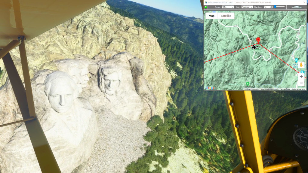
WP4: [30.30 NM] MT RUSHMORE
WP5: [7.60 NM] CRAZY HORSE MEMORIAL
WP6: [14.56 NM] BLACK HILLS NAT'L FOREST
WP7: [50.52 NM] DEVILS TOWER
W43: [7.63 NM] HUELETT MUNICIPAL
Total Distance: 181.41 NM
Flightplan by texstan
Login is required to download. If you don't have an account Register Here, your password will be emailed to you. Happy Flying!