
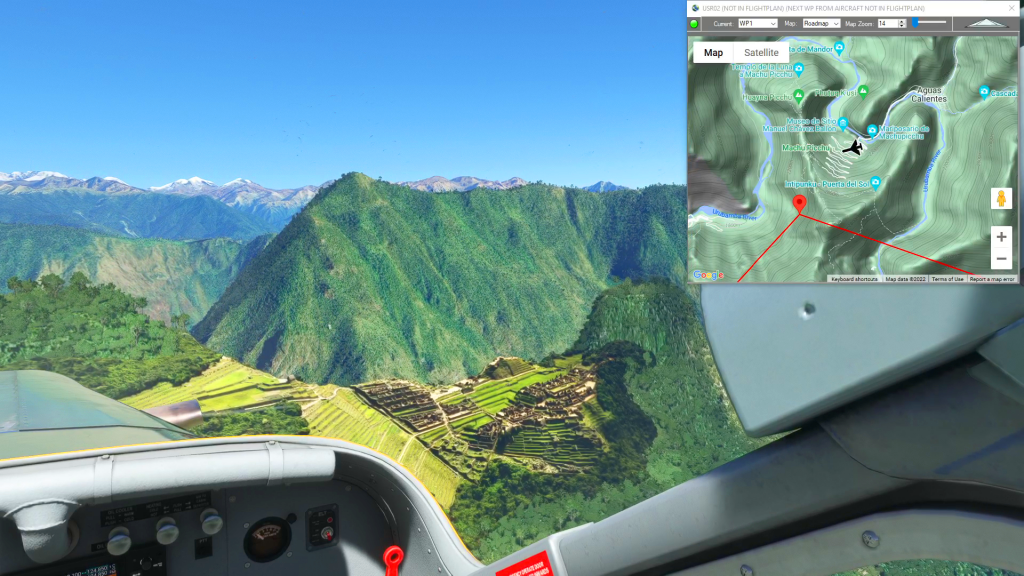
This flight plan starts at Andahuayla Airport at 3,600' as you gradually climb through the Andes to the peak of Padreyoc Mountain at nearly 20,000'. From there you can gently descend into the valley that cradles Machu Picchu at it's center. This flight plan then takes you southeast to Cusco passing the Inti Punku Sun Gate, Ollantaytambo, Pumamarca and Moray before passing over Saqsaywaman and landing at Cusco Int'l.
For the best experience, check out the Scenery mod at https://flightsim.to/file/14281/machu-picchu
Special thanks to MSFSItalia!
SPHY-SPZO Andahuaylas to Cusco
Pilatus PC-6 G950 Wheels
SPHY: ANDAHUAYLAS
WP1: [40.96 NM] PADREYOC MOUNTAIN
WP2: [17.15 NM] MACHU PICCHU
WP3: [14.44 NM] INTI PUNKU SUN GATE
WP4: [2.79 NM] OLLANTAYTAMBO / TEMPLO DEL SOL
WP5: [5.83 NM] MORAY
WP6: [16.57 NM] SAQSAYWAMAN
WP7: [0.40 NM] CATEDRAL del CUZCO
SPZO: [2.55 NM] CUSCO INTERNATIONAL AIRPORT
Total Distance: 100.71 NM
Login is required to download. If you don't have an account Register Here, your password will be emailed to you. Happy Flying!