
This flight plan contains a selection of waypoints taken from the Mysteries of the Abandoned TV show on Science Channel. Using the latitude and longitude from the show, this flight spans the Italian Alps with 5 locations from the show including the Vajont Dam. There are also many castles and other historic sites to find along the way.
Summary of Mysteries of the Abandoned Episodes:
WP1 Season 3 Episode 5 - Bergamo, Italy N46° 00' 57.6", E10° 04' 26.7" - Gleno Dam: Built to provide power for but collapsed in 1923, when bombed by anarchists. Built c1917.
WP2 Season 2 Episode 4 - Cresta Croce, Italy N46° 09' 39.6" E10° 33' 31.3" - Croce Ridge Cannon: 6 ton cannon hauled to the top of a 10,000' mountain ridge in WWI to defend Italy from Austria.
WP3 Season 1 Episode 3 - 52 Tunnel Road, Italy N45° 46' 45.33", E11° 13' 40.87" - 4 mile long road carved into the mountains at 6500', Created to defend Venice from attack via the Alps at Monte Pasubio.
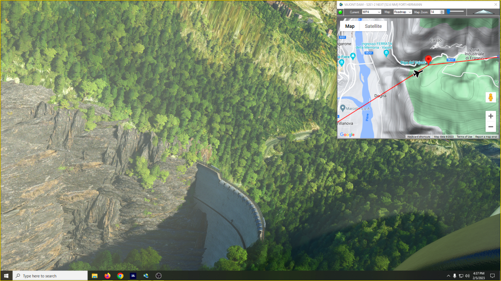
WP4 Season 2 Episode 1 - Belluno, Italy N46° 16' 02.9", E12° 19' 45.1" - Vajont Dam: Intended hydroelectric dam c1957, breached by landslide in 1963.
WP5 Season 6 Episode 8 - Bovec, Sloveniea N46° 21' 35.1", E13° 35' 16.8" - Fort Hermann: Built c1900 to defend against Italian
attack from the Bovec Basin below.
This is the flight plan used in the YouTube video https://youtu.be/I0pdJcgh-rg
Mysteries of the Abandoned Locations LIMC-LJBO
DA40-NG Asobo
LIMC: MILAN AIRPORT
WP1: [60.76 NM] GLENO DAM - COLLAPSED 1923 - S3E5-1
WP2: [21.96 NM] CROCE RIDGE CANNON - WWI ERA - S2E4-4
WP3: [36.10 NM] 52 TUNNEL ROAD - S1E3-3
WP4: [54.43 NM] VAJONT DAM - S2E1-2
WP5: [52.46 NM] FORT HERMANN
LJBO: [2.45 NM] BOVEC AIRPORT
Total Distance: 228.17 NM
Flightplan by texstan
Login is required to download. If you don't have an account Register Here, your password will be emailed to you. Happy Flying!