
Shiprock Airstrip to Olijato Regional
DA40-NG Asobo
If you set the altitude hold to about 1000' above the ground, you can let the Autopilot fly a pattern through the mesas in Monument Valley while you use the Drone to enjoy the view from outside the cockpit. This Flightplan is basically the same as leg 2 of the Navajo Volcanic Field series except for the addtional waypoints to fly through the mesas in Monument Valley.
5V5: SHIPROCK AIRSTRIP
POI09: [13.61 NM] HWY 64
POI10: [10.63 NM] AZ BORDER/PASTORA PEAK
POI11: [17.75 NM] WILLOW SPRING WASH
POI12: [10.51 NM] CHINLE CREEK
POI13: [8.04 NM] PASS IN THE RIDGE
POI14: [3.95 NM] ROOSTER ROCK
POI15: [7.12 NM] SENTINAL MESA/MONUMENT VALLEY
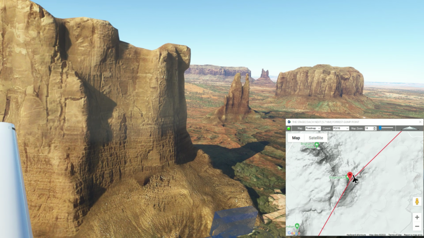
POI16: [3.04 NM] THE STAGECOACH
POI17: [5.76 NM] FORREST GUMP POINT
POI18: [7.07 NM] EAGLE MESA
POI19: [7.03 NM] TRAIN ROCK
UT25: [5.09 NM] OLJATO REGIONAL AIRPORT
Total Distance: 99.64 NM
Note: In the video the DA40-NGX Improvement Mod has been used which makes the DA40 much easier to fly - you can check it out at https://flightsim.to/file/2738/da40-ngx-project
Thank you to mrtommymxr for the excellent mod.