
This is leg 5 of a multi-leg flight from Crownpoint, NM to Moab, UT across the vast Navajo Volcanic Field. Take off from Hite Airstrip along the Colorado River and hug the river as you fly north through deep canyons of the Canyonlands Nat'l Park to Arches Nat'l Park to see how many arches you can find.
This is the flight plan used in the YouTube video https://youtu.be/h09U-RjnY1g
Note: In the video the DA40-NGX Improvement Mod has been used which makes the DA40 much easier to fly - you can check it out at https://flightsim.to/file/2738/da40-ngx-project
Thank you to mrtommymxr for the excellent mod.
UT03 to KCNY Hite to Canyonlands
DA40-NG Asobo
UT03: HITE AIRSTRIP
WP1: [9.06 NM] ROCKFALL CANYON
WP2: [8.13 NM] GYPSUM CANYONWP1:
WP3: [7.18 NM] THE NEEDLES CANYON
WP4: [4.61 NM] SPANISH BOTTOM
WP5: [2.64 NM] COLORADO / GREEN RIVER CONFLUENCE
WP6: [4.60 NM] THE LOOP
WP7: [4.56 NM] SHEEP BOTTOM
WP8: [3.40 NM] LATHROP CANYON / AIRPORT TOWER
WP9: [5.25 NM] THELMA & LOUISE POINT / FIEDLER ARCH
WP10: [4.65 NM] SAFARI BEACH / ANTICLINE OVERLOOK
WP11: [4.30 NM] THE BILLBOARD / JUG HANDLE ARCH
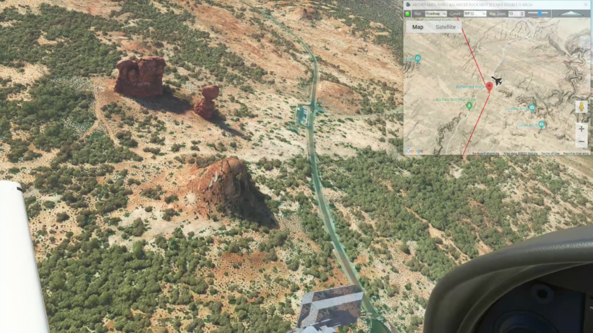
WP12: [10.26 NM] ARCHES NAT'L PARK / BALANCED ROCK
WP13: [6.51 NM] DOUBLE O ARCH / LANDSCAPE ARCH
KCNY: [6.83 NM] CANYONLANDS FIELD AIRPORT
Total Distance: 82.06 NM
Note: In the video the DA40-NGX Improvement Mod has been used which makes the DA40 much easier to fly - you can check it out at https://flightsim.to/file/2738/da40-ngx-project
Thank you to mrtommymxr for the excellent mod.