
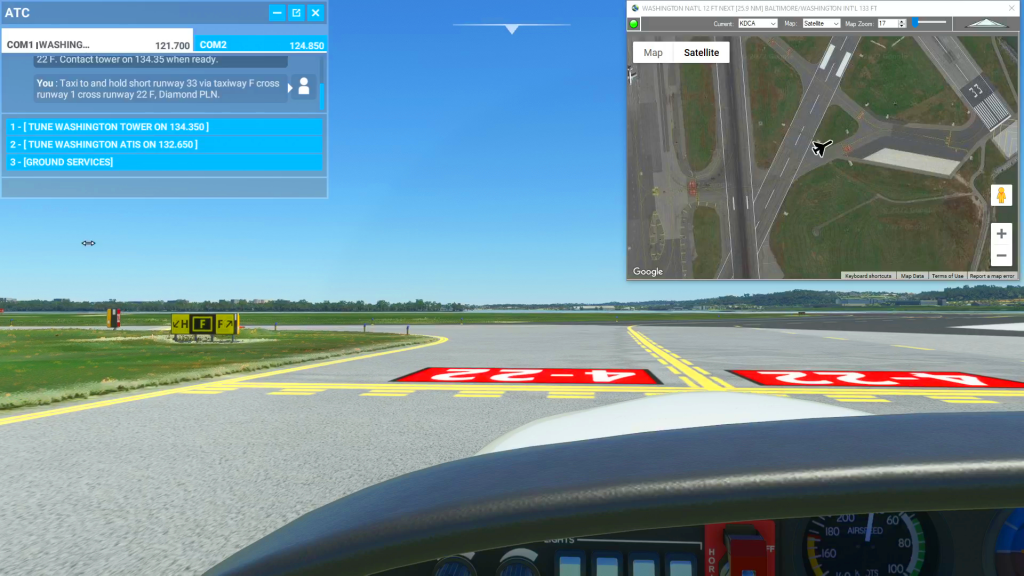
How to use satellite view to taxi flight plan
Flight Simulator
Flightplan is a Google Maps flight planning add-on for use with Microsoft Flight Simulator 2020. You can use Cockpit Map to take Google Maps in the cockpit with you to use real time terrain elevations, road maps, landmarks, satellite views and street view 3D imagery. Flightplan can also be used to create and share your own flight plans using an interactive drag-and-drop, Google Maps interface.
Download Flightplan and try it for yourself at the bottom of the page.
Download and fly any of the flight plans below, just load them in MSFS World Map and your ready to fly.
For more information see the FAQ page or our YouTube channel.
Happy Flying!
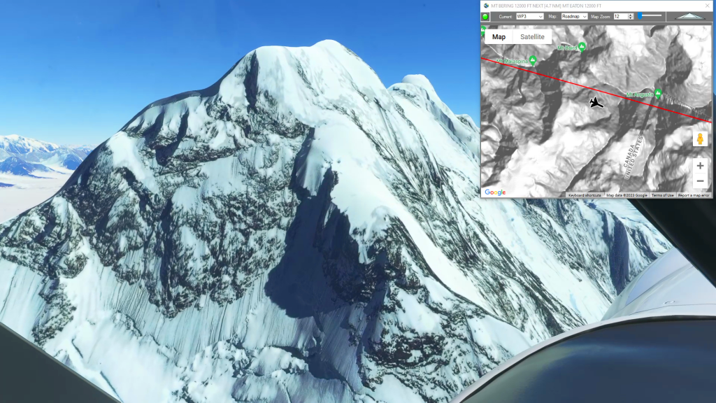
Icy Bay to Mt Logan Glacier Landing
Icy Bay Airport To Mt Logan Glacier Landing Flight Plan
How To Use Flightplan to Assist With Glacier Landings
Glacier Landing Flight Plan
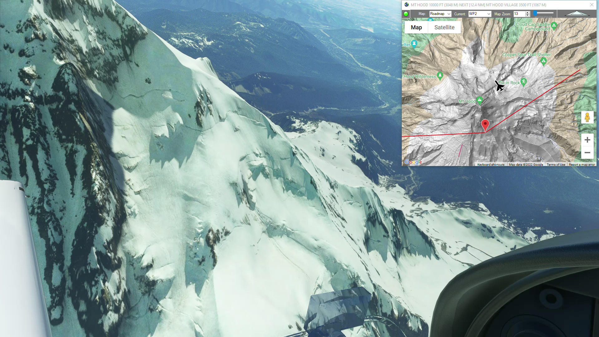
Mt Hood (Columbia Regional to Portland Int’l)
Mt Hood flight plan
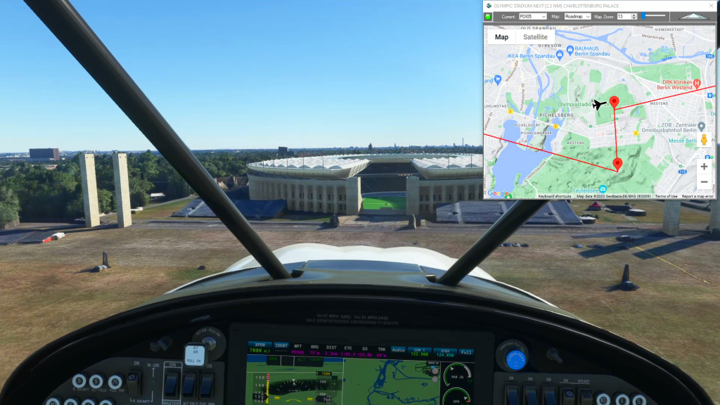
Mysteries of the Abandoned – Berlin
Kremmen-Hohenbruch To Schonhagen Airport Flight Plan
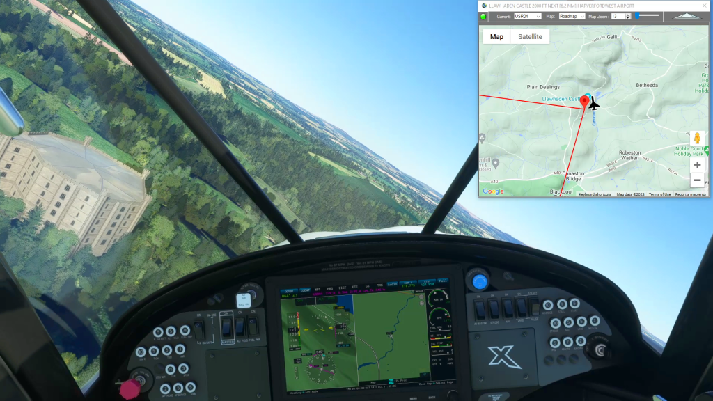
Welsh Castles – Dinefwr Castle
Pembrey Airport To Harverfordwest Airport Flight Plan
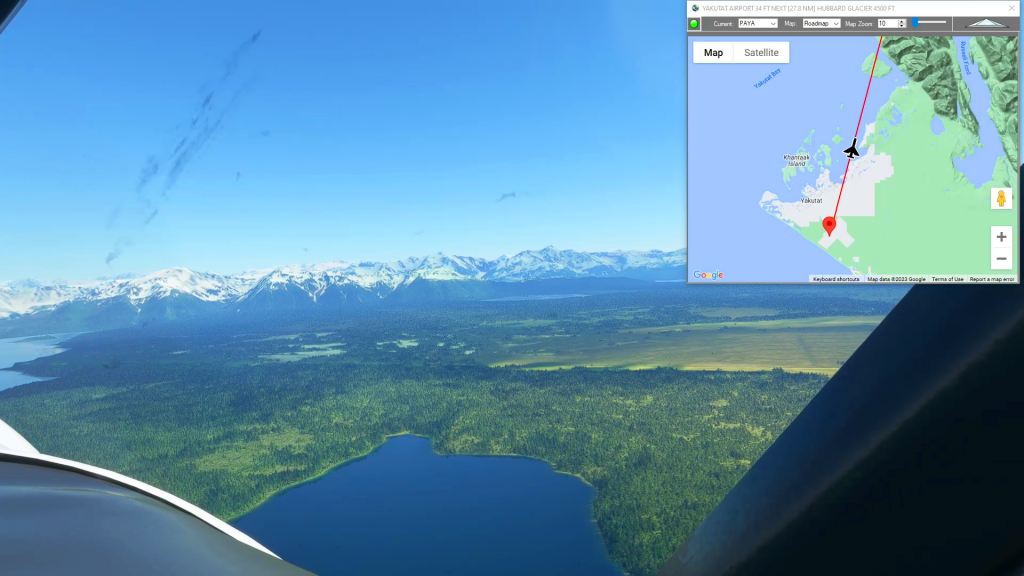
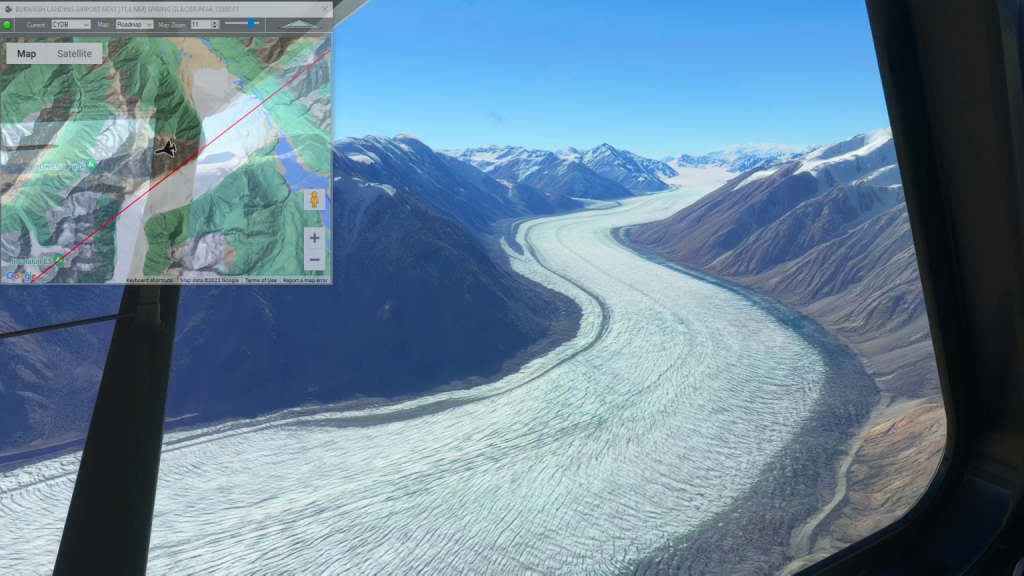
Yakutat to Icy Bay
Yakutat Airport To Icy Bay Airport Flight Plan
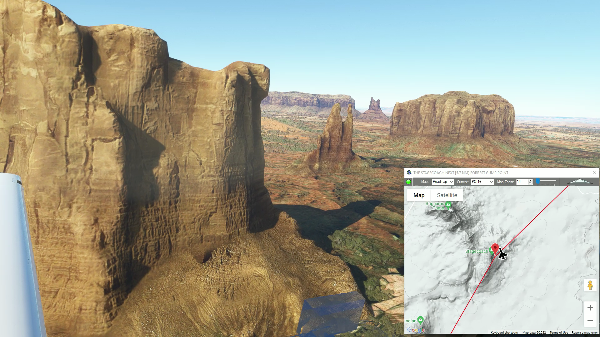
Monument Valley Drone Flight
Monument Valley Drone Flight flight plan
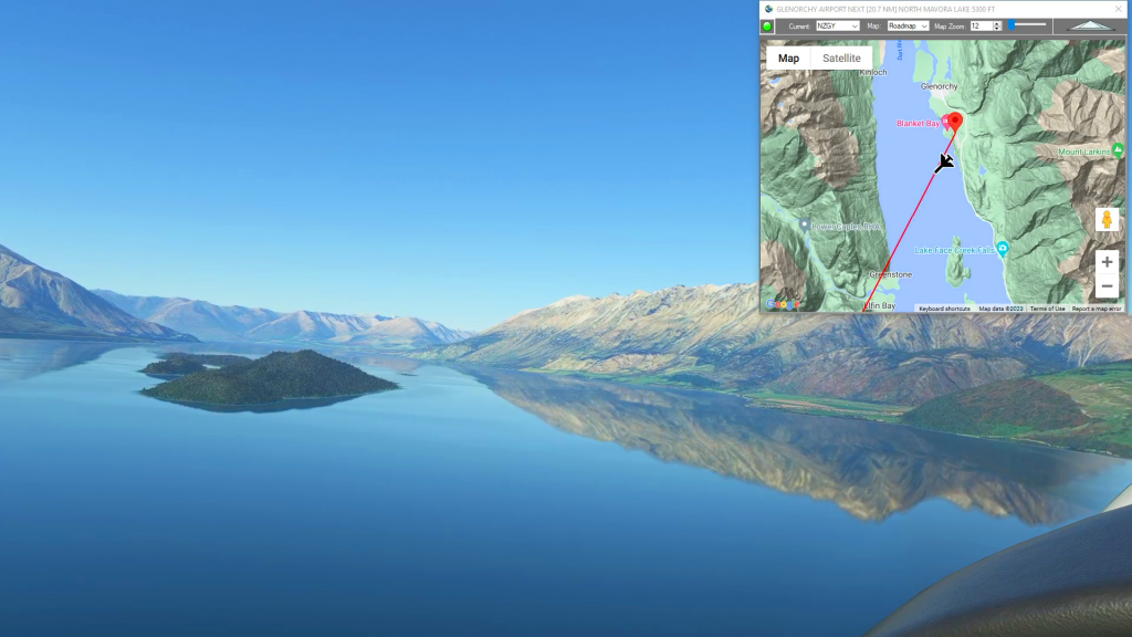
Middle Earth – Fangorn Forest
Glenorchy Airport To Anau-Manapouri Airport Flight Plan

How To Change The Start Position of Your Aircraft
How to change your start position flight plan