

Shiprock Airstrip To Oljato Regional Airport Flight Plan
Flight Sim Downloads
Simflightplan™ is a Google Maps flight planning add-on for use with Microsoft Flight Simulator. You can use Cockpit Map to take Google Maps in the cockpit with you to use real time terrain elevations, road maps, landmarks, satellite views and street view 3D imagery.
Download Simflightplan™ and try it yourself. You can also download and fly any of our free flight plans, try the flight plans below or click the Downloads link at the top to search all downloads. Load them in MSFS World Map and you are ready to fly.
For more information see the FAQ page or our YouTube channel.
Happy Flying!

Wales Castles – Raglan and Cardiff
Gloucestershire Airport To Cardiff Airport Flight Plan
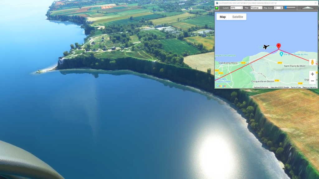
French D-Day Coastline
Cherbourg-Mache Airport To Caen-Carpiquet Airport Flight Plan
5.0 out of 5 stars (based on 1 review)

Myst of the Abandoned Southern England
Lower Manor Farm Airstrip To Swanborough Farm Airstrip Flight Plan
5.0 out of 5 stars (based on 1 review)

Mt Ranier (Strom Field to Pierce County Airport)
Mt Ranier flight plan