

- Version
- Download 8
- File Size 0.00 KB
- File Count 1
- Create Date February 27, 2026
- Last Updated February 27, 2026
-
Login is required to download. If you don't have an account Register Here, your password will be emailed to you. Happy Flying!
This route follows the Blue Nile from its source at Lake Tana in Etheopia to Khartoum, Sudan where the Blue Nile and the White Nile meet and become the Nile River flowing north into Egypt
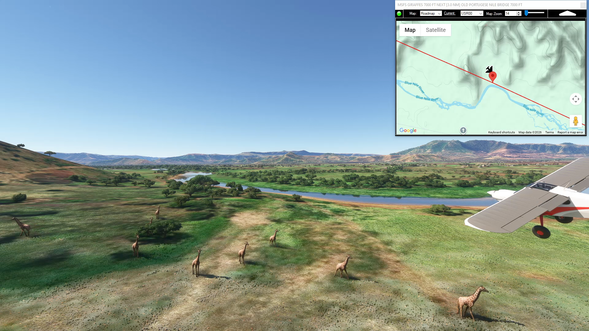
Just a few miles out of the Bahir Dar Intl Airport there is a waypoint for a herd of giraffes near the bank of the Blue Nile..
Bahir Dar to Khartoum
Asobo NXCub
HABD: BAHIR DAR INTL AIRPORT
USR00: [14.72 NM] MSFS GIRAFFES
USR01: [2.94 NM] OLD PORTUGESE NILE BRIDGE
USR02: [20.43 NM] GALE
USR03: [19.40 NM] YEUA
USR04: [19.96 NM] BASHILO RIVER
HAMA: [24.53 NM] MEKANE SALAM AIRPORT
USR05: [25.75 NM] WALAQA RIVER
USR06: [15.77 NM] JAMMA RIVER
USR07: [9.93 NM] A3 HIGHWAY BRIDGE
USR08: [18.04 NM] MUGER RIVER
USR09: [15.74 NM] GUDER RIVER
HAFN: [24.08 NM] FINCHA AIRPORT
USR10: [25.56 NM] FINCHAA RIVER
USR11: [25.90 NM] HIGHWAY 32 BRIDGE
USR12: [30.50 NM] BLUE NILE RIVER BEND
USR13: [29.66 NM] LEBU
USR14: [32.24 NM] DIDESA RIVER
USR15: [28.51 NM] BOKA WENZ
HASO: [45.20 NM] ASONSA AIRPORT
USR16: [48.87 NM] DABUS RIVER
USR17: [28.98 NM] MELAKEBIRHAN ISLAND
USR17_0: [10.31 NM] ABBAY DAM BRIDGE
USR18: [50.70 NM] ROSEIRES RESERVOIR
HSDZ: [6.52 NM] DAMAZIN AIRPORT
USR19: [59.25 NM] BARANKWAH
HSEU: [50.13 NM] AL HAWATAH AIRPORT
USR20: [57.77 NM] SENNAR DAM
USR21: [52.19 NM] WAD MADANI
USR22: [50.45 NM] WAD RAWAH
HSSK: [42.24 NM] KHARTOUM INTL AIRPORT
Total Distance: 886.41 NM
Flightplan by texstan
| File | |
|---|---|
| Blue Nile |
Would be nice if you could just download this as a PLN
The .PLN file is inside the .zip download. You can load it instead of the .FLT, but no guarantee the giraffes will be there.