
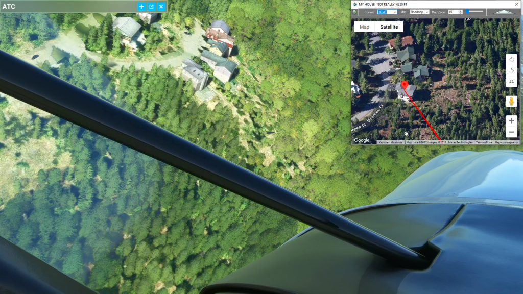
In the video we use the satellite view of Flightplan to find our house. We then use Cockpit Map to fly the flight plan and show you how to add waypoints on-the-fly.
This is the flight plan used in the YouTube video https://youtu.be/0NPcjYF6N3A
KTVL to KTVL Lake Tahoe
Asobo XCub
KTVL: LAKE TAHOE AIRPORT
HOME: [17.36 NM] MY HOUSE (NOT REALLY)
WP1: [10.72 NM] SECRET COVE NUDE BEACH
KTVL: [15.84 NM] LAKE TAHOE AIRPORT
Total Distance: 43.94 NM
Flightplan by texstan
Login is required to download. If you don't have an account Register Here, your password will be emailed to you. Happy Flying!